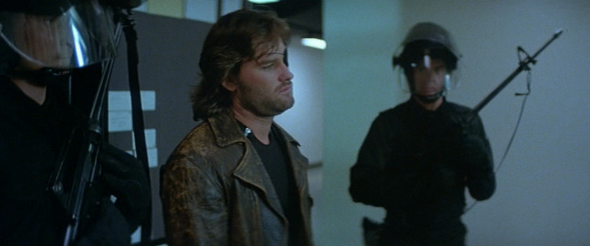
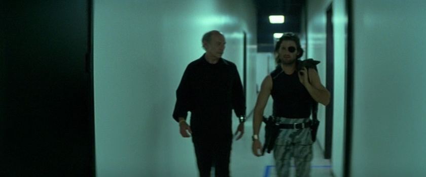
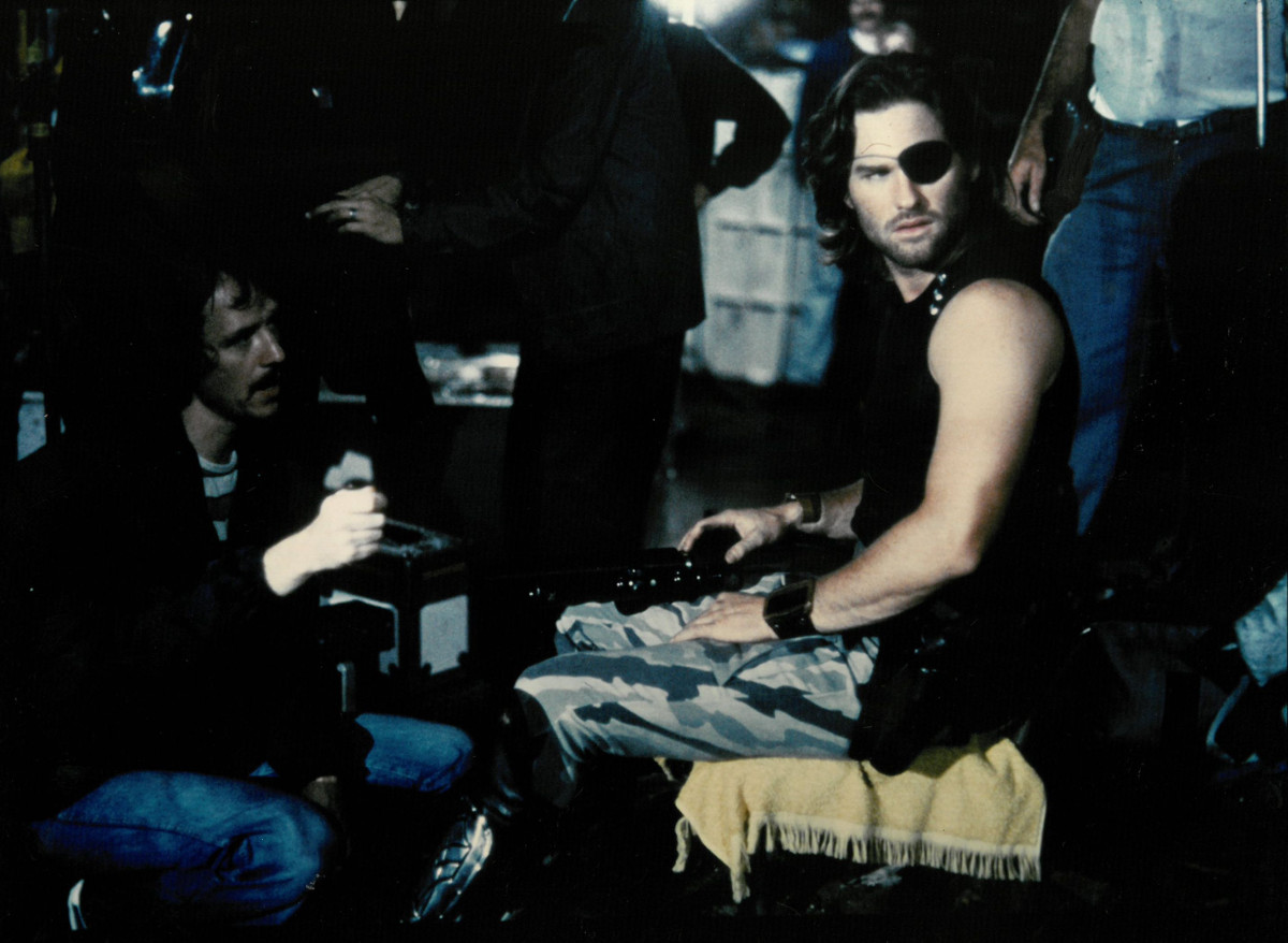
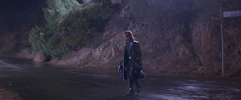
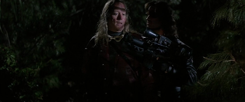
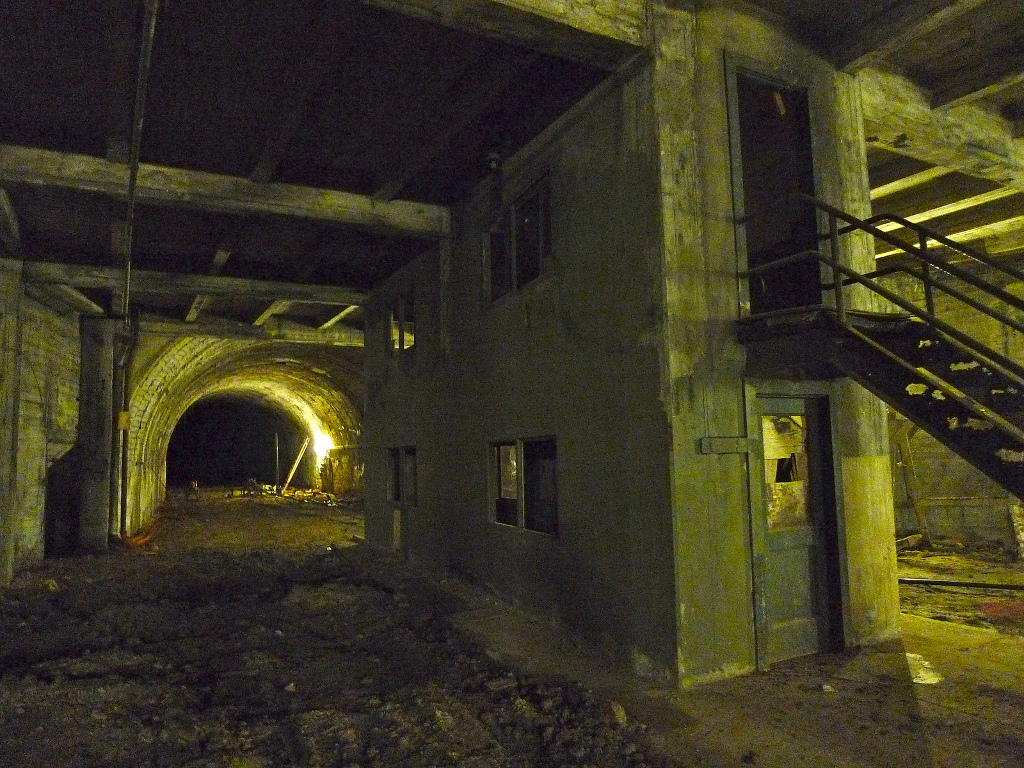
Multimedia > Shooting Locations > Escape From New York (Photo Removal/Credit: andreasj1981@hotmail.com)
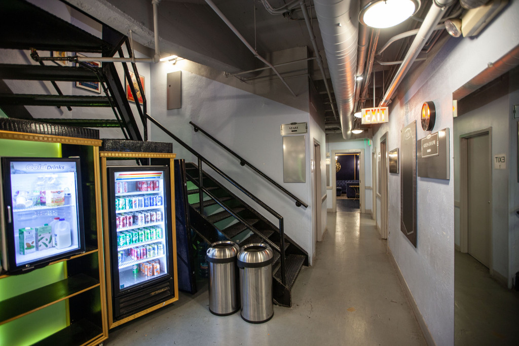
Studios/Facilities:
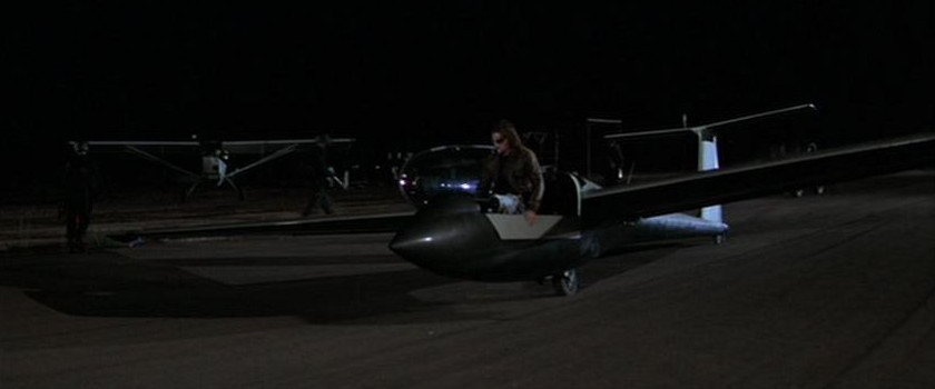
Culver Studios (Air Force One/Glider/Car Interiors)
9336 West Washington Boulevard, Culver City, CA 9023
New World Pictures/Venice Effects Facility (Special Visual Effects)
600 S. Main St., Venice, CA 90291
Dream Quest/Mar Vista Effects Facility (Special Visual Effects: Graphic Display Models)
12524 Indianapolis St., Los Angeles, CA 90066
Georgia
 >
>
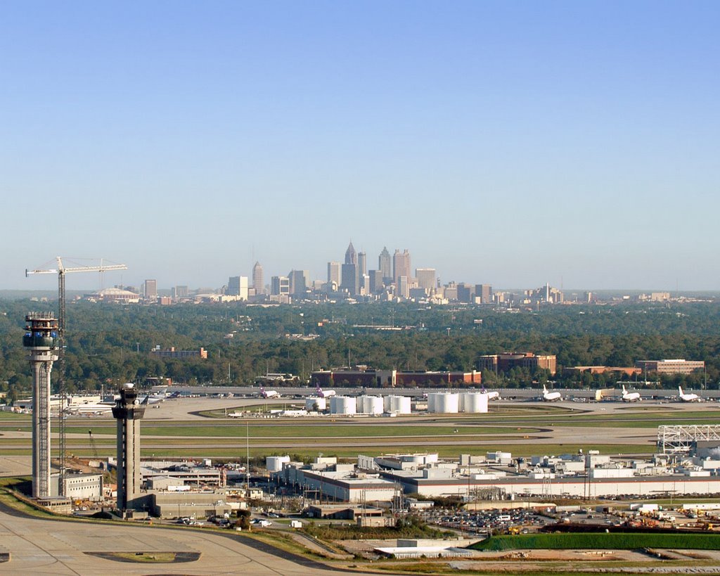
Colorado Terminal Corridor (Deleted Scenes) (Hartsfield-Jackson Atlanta International Airport, Concourse A, Moving Walkway, Atlanta, GA) (Satellite View)
Description: Hartsfield-Jackson Atlanta International Airport is one of the busiest passenger airports in the world. Only O'Hare International Airport in Chicago, Illinois, rivals Hartsfield-Jackson in passenger volume and in number of takeoffs and landings. In 2012 Hartsfield-Jackson handled more than 2,500 arrivals and departures, bringing more than 250,000 passengers through the airport on an average day. Monthly the airport handles about 54,000 metric tons of cargo and more than 60,000 metric tons of mail on airliners and cargo aircraft.
The facility is named after two important Georgia politicians: William B. Hartsfield and Maynard Jackson. Hartsfield, a former alderman and mayor of the city of Atlanta, founded the airport at the site of an abandoned racetrack in 1925 and became its first commissioner. With support from the city and the attraction of such companies as Delta Air Lines and Eastern Air Lines, Hartsfield Airport grew quickly. The name Jackson was added to Hartsfield Atlanta International Airport in 2003, after the death of former Atlanta mayor Maynard Jackson. Jackson was the first African American to serve as mayor of a major southern city.
6000 North Terminal Parkway Suite 4000
Atlanta, GA 30320
http://www.atlanta-airport.com
https://en.wikipedia.org/wiki/Hartsfield Jackson Atlanta International-Airport
 >
>
 >
>
 >
>
 >
>
 >
>
 >
>
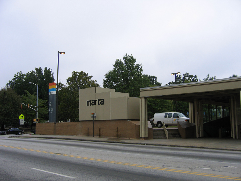
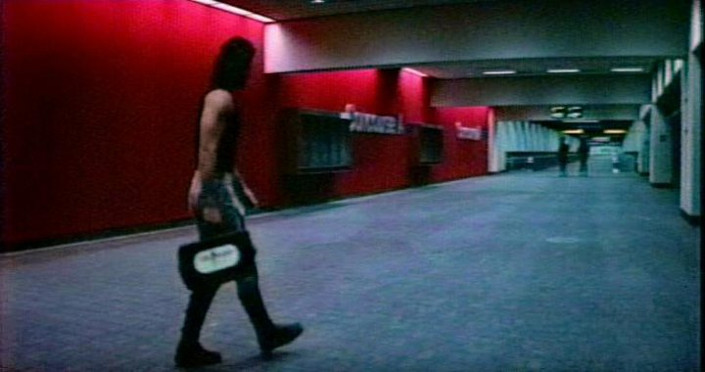
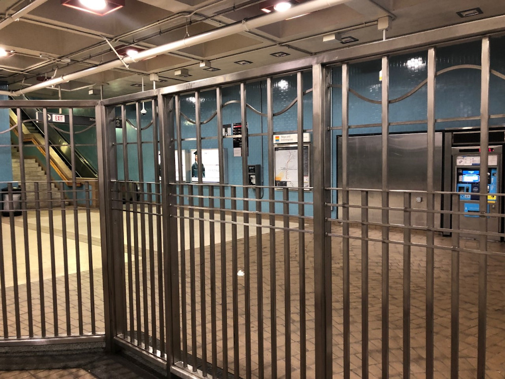
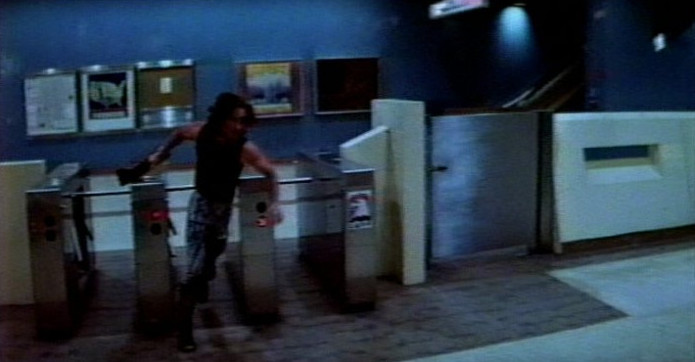
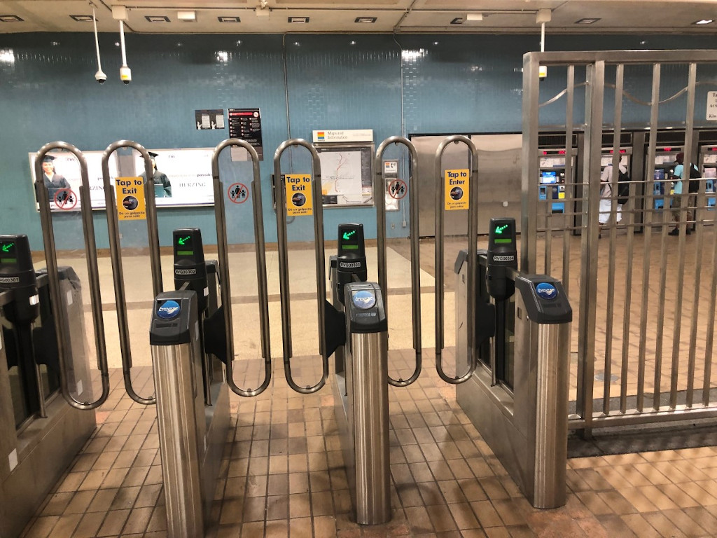
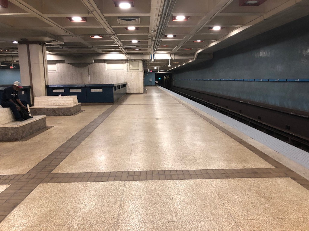
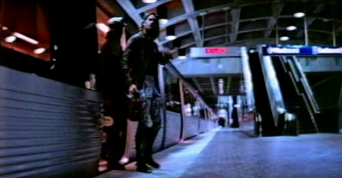
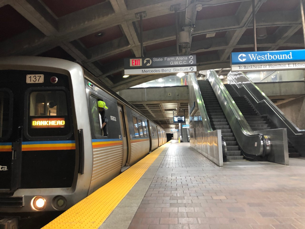
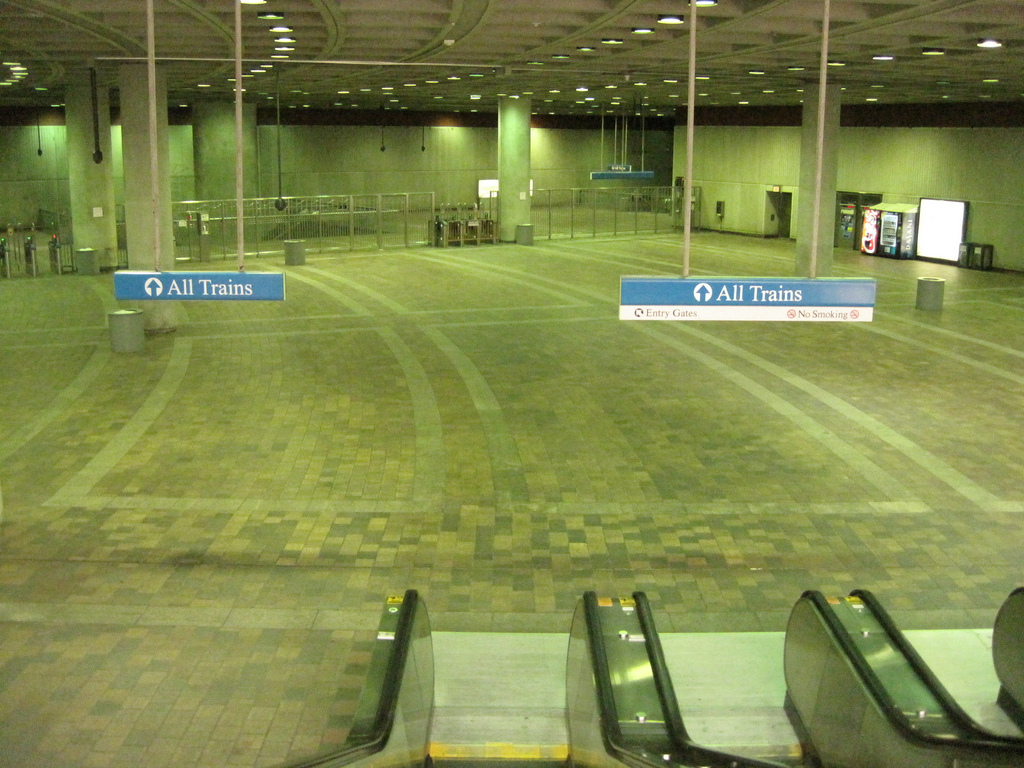
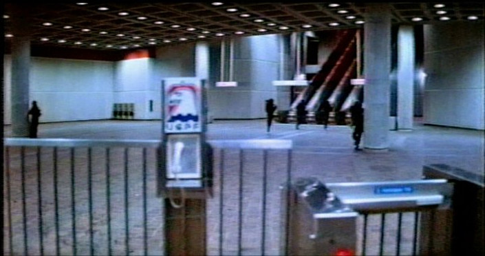
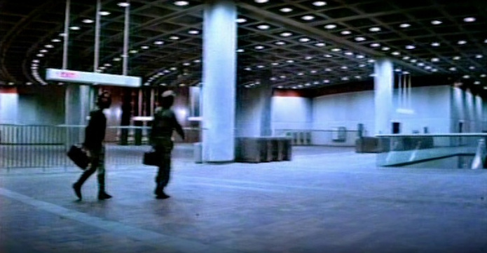
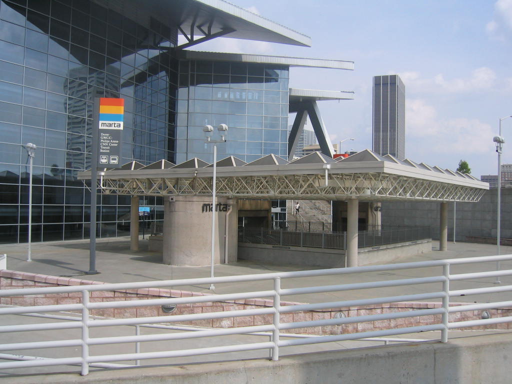
Colorado Subway Platform (Deleted Scenes) (Ashby Station, Westbound Platform, Atlanta, GA) (Atlanta's MARTA System) (Street View)
Description (MARTA): The Metropolitan Atlanta Rapid Transit Authority (Marta) operates the subway and bus system in the City of Atlanta, Fulton and DeKalb counties. The rail system currently has 36 stations with 46 route miles. MARTA carries about 250,000 rail passengers on weekdays.
Description (Ashby Station): The Ashby station is an unusual configuration. It is an underground station on two levels, with one track on each level. (If both tracks were on the same level, it would resemble one island platform and a side platform on the eastbound side.) The tracks are nearly over one another. You can see the tunnels split right past the west end of the station. The walls along the platform are marble, and the walls next to the track are blue tile. The ceiling is a waffle design painted white. There is a painting on the westbound platform, on the blue tile. This mural depicts the city of Atlanta and Atlanta University Center. The railing that keeps you from falling down to the lower level is painted blue. This station was opened on December 22, 1979.
Comment (Andreas/Webmaster): "The train Snake and Taylor gets on is actually running in the wrong direction on the westbound track to tie it in with the Dome/GWCC/Philips Arena/CNN Center Station where the rest of the scenes from this sequence were shot two stations away from the eastbound track."
65 Joseph E. Lowery Blvd
Atlanta, GA 30314
http://www.itsmarta.com/ew-ash-overview.aspx
https://en.wikipedia.org/wiki/Ashby (MARTA station)
 >
>
 >
>
 >
>
 >
>
 >
>
 >
>
 >
>
 >
>
 >
>
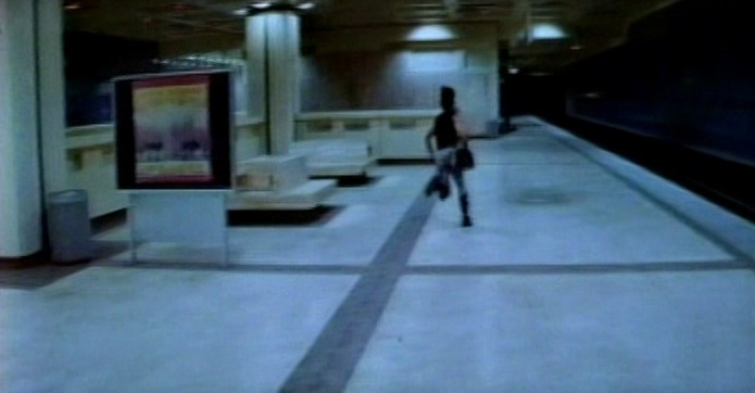
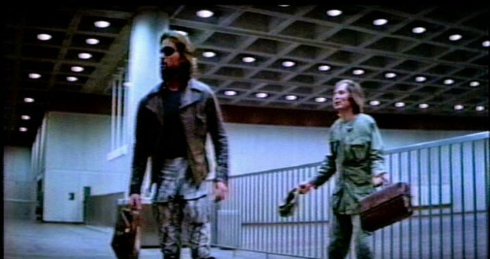
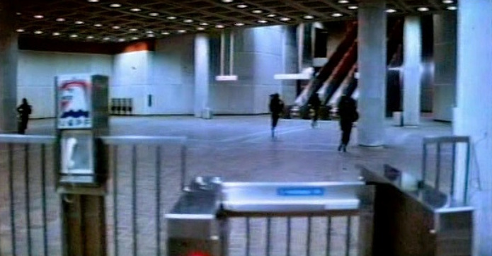
San Francisco Subway Platform/Upper Lobby (Deleted Scenes) (Dome/GWCC/Philips Arena/CNN Center Station, Atlanta, GA) (Ex Omni Station) (Atlanta's MARTA System) (Street View)
Description: Single island platform, two tracks, underground. The ceiling over the mezzanine and platform is waffled, and in each of the squares inside of them, there is an orange panel. Part of the ceiling over the platform is an arched waffle. Everything is made of cement. The west end of the station is briefly at the surface, covered by road bridges. Just past the station, the train goes back underground. This station has the most number of faregates and escalators to handle the crowds for events at the former Omni and Georgia World Congress Center. Today it services the new Phillips Arena, Georgia World Congress Center and Georgia Dome. While travel up or down the escalators there is concrete mural depicting the industrial revolution. This station was opened on December 22, 1979.
100 Techwood Drive, NW
Atlanta, GA 30303
http://www.itsmarta.com/ew-omn-overview.aspx
https://en.wikipedia.org/wiki/Dome/GWCC/Philips Arena/CNN Center (MARTA station)
Missouri
A Look Back • 1976 Fire Along Locust Street Was One For The Ages (stltoday)
April 2, 1976: Downtown St. Louis Firestorm (KSDK)
1976 - St. Louis Missouri Firestorm 21st And Locust (firebuffpatrol.createaforum)
A Look Back • Searing Heat Wave Killed 153 In St. Louis In 1980 (stltoday)
St. Louis Ranked 3rd On Dangerous Cities List (cbslocal)
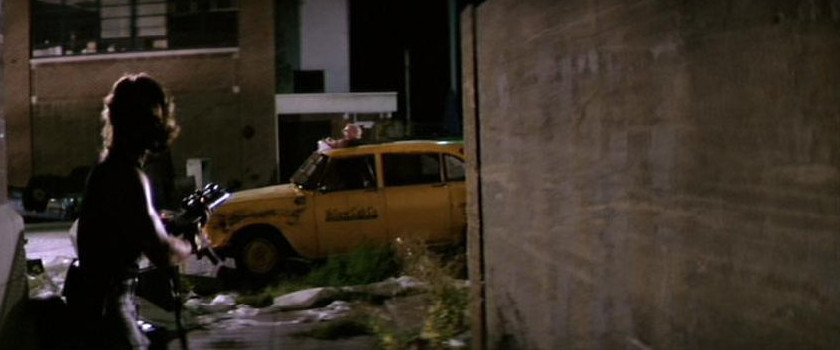
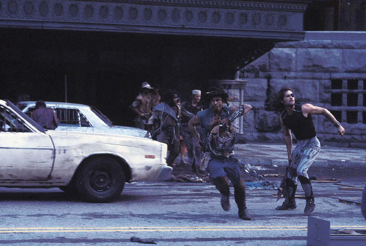
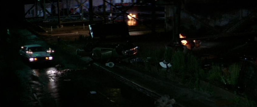
Chopper Landing Site/Street (Plissken) (Deleted Scenes) (St. Charles St. btw 16th and 17th streets, Parking Lot, St. Louis, MO) (Street View)
http://www.builtstlouis.net/washington/15a.html
http://www.builtstlouis.net/washington/17a.html
 (Street
View) >
(Street
View) >
 (Street
View) >
(Street
View) >
 (Street
View)
(Street
View)Street (Escape Pod) (St. Charles St. btw 17th and 18th streets, St. Louis, MO)
Comment (Erik Markarian): "Where the pod actually crashed, in the movie it is an extension to an existing building to make it look like a hole was made in the wall. It would be where the wooden fence partition is. Nowadays from what I could see, that section is actually the front of a tenement-type of building and the fenced-off portion in my pictures is a child's play area with a few toys and things in there."
 (Street
View) >
(Street
View) >
 (Street
View)
(Street
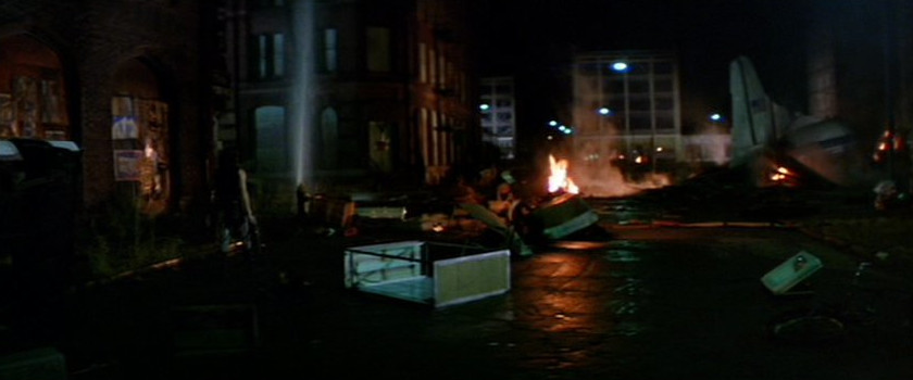
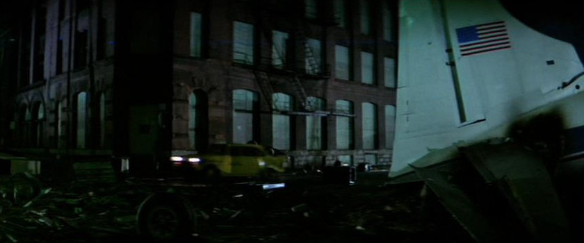
View)Street (Air Force One Wreckage) (N. 21st St. btw St. Charles St. and Olive St., St. Louis, MO)
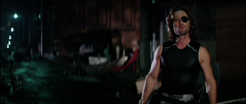
Description: In this part Snake (Kurt Russell) walks by the Swift Printing Company building in downtown St Louis. It was abandoned since Swift's move out in 1969. The building was renovated in 1991, and is now the home of the St. Louis Brewing Company - the makers of the Schlafly brand of beers.
http://www.builtstlouis.net/central-corridor/downtown-west/locust-street03.html
http://www.builtstlouis.net/central-corridor/downtown-west/washington-avenue02.html
http://www.builtstlouis.net/central-corridor/downtown-west/washington-avenue03.html
Air Force One Wreckage (20th Locust St., St. Louis, MO) (Locus Business District) (Street View)
Comment (Andreas/Webmaster): "A St. Louis Housing Authority warehouse once stood here. It was destroyed by the fire in 1976."
http://www.builtstlouis.net/central-corridor/downtown-west/washington-avenue02.html
http://www.builtstlouis.net/central-corridor/downtown-west/washington-avenue03.html
 (Street
View) >
(Street
View) >
 (Street
View)
>
(Street
View)
>
 (Street
View) >
(Street
View) >
 (Street
View)
(Street
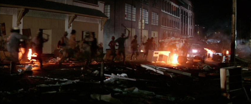
View)Alley/Broadway (Locust St. btw 21st and 22nd streets, St. Louis, MO) (Locus Business District)
Description: Incorporated in 1982 as a special tax district, the Locust Business District has expanded its objective to stimulating community morale and facilitating economic growth through the accommodation of emerging commercial markets.
http://www.locustbusinessdistrict.com/
http://www.builtstlouis.net/central-corridor/downtown-west/locust-street01.html
http://www.builtstlouis.net/central-corridor/downtown-west/locust-street02.html
http://www.builtstlouis.net/central-corridor/downtown-west/locust-street03.html
 >
>
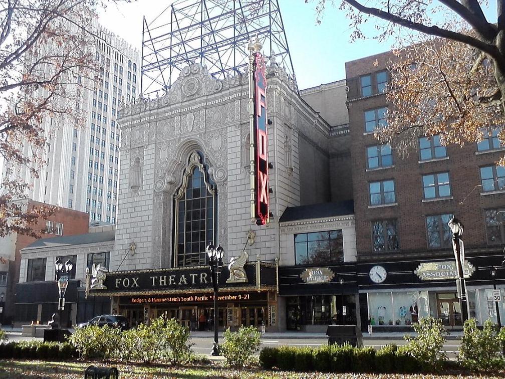
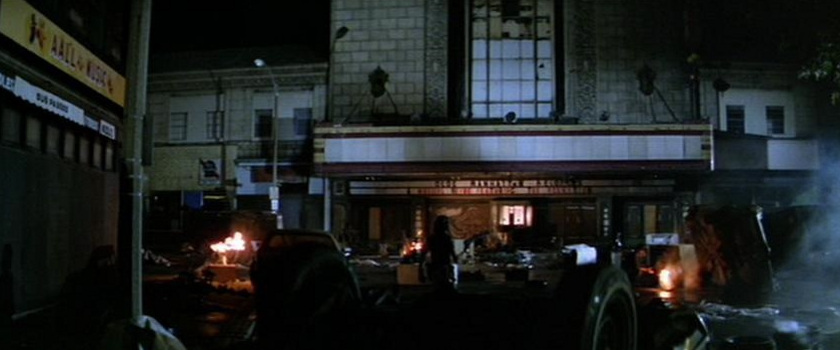
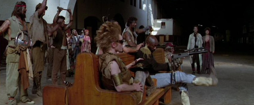
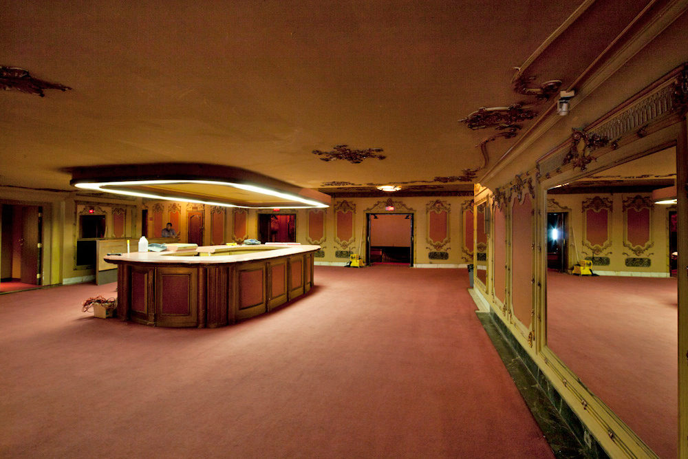
Theater (Entrance) (Fox Theatre, St. Louis, MO) (Grand Center) (Street View)
Description: "No longer need residents of St. Louis look beyond their own city for the finest entertainment." This statement was coined by the William Fox Circuit of Theatres in 1929 for the opening of their newest, most exotic temple of amusement, and it still holds true! It was originally opened as a movie theater and the theater was restored to its original glory in 1981.
527 N. Grand Blvd
St. Louis, MO 63103
http://www.fabulousfox.com/
http://www.builtstlouis.net/midtown/05a.html
https://en.wikipedia.org/wiki/Fox Theatre (St. Louis)
Chock full o'Nuts (Rear Of Building) (St. Charles St. btw 22nd and 23rd streets, St. Louis, MO) (Street View)
Street (Bridge)/69th Street Bridge (Girders) (MacArthur Bridge, Chouteau's Landing, St. Louis, MO)
Description: Located a few blocks from Busch Stadium, Chouteau's Landing is one of St. Louis' oldest districts. With 58 acres slated for mixed-use redevelopment, Chouteau's Landing will soon be transformed into an energetic art district distinctively styled with SoHo-style lofts, historic commercial buildings and new construction.
Creative entrepreneurs are already moving their businesses to Historic Fourth Street with its rare collection of 19th-century commercial buildings that will seamlessly merge with new construction. The launch of Chouteau's Landing's Historic Fourth Street will be followed by seven progressive years that include a 122,000-square-foot interactive arts center, art-filled greenspace and pedestrian friendly streetscapes.
Located just south of Highway 40 and Busch Stadium between South Fourth Street and the Riverfront, Chouteau's Landing will feature an edgy artistic sensibility and an intricately layered landscape that attracts a diverse community of savvy urbanites.

Street (Bridge) (South side of the MacArthur Bridge btw S. 2nd St. and Risley St.) (Street View)
 >
>
 (Deleted Scenes)
69th Street Bridge (Girders) (North side of the MacArthur Bridge/Lombard St./Risley St.) (Street View)
http://www.chouteauslanding.com
http://www.builtstlouis.net/macarthur.html
https://en.wikipedia.org/wiki/MacArthur Bridge (St. Louis)
 (Street
View)
>
(Street
View)
>
 (Street
View)
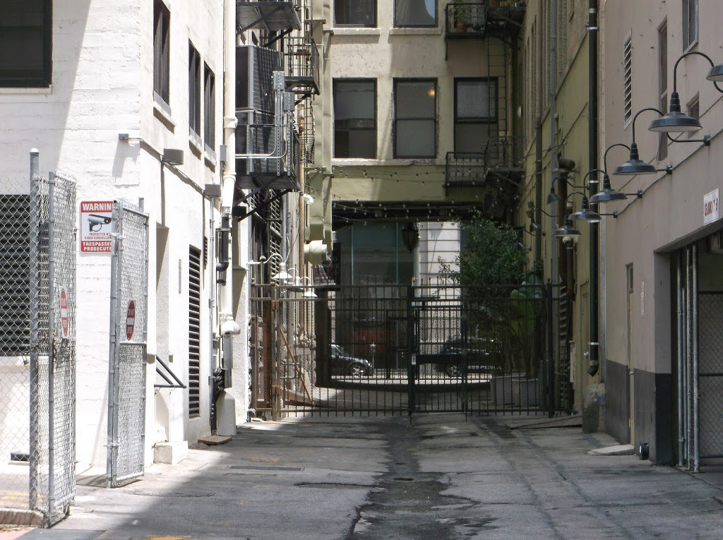
(Street
View)Alley Near Library/Street (Caravan) (W. 16 St. btw Washington Ave. and Lucas Ave, St. Louis, MO) (Washington Avenue Historic District)
Description: The Washington Avenue Historic District is located in Downtown West, St. Louis, Missouri along Washington Avenue, and bounded by Delmar Boulevard to the north, Locust Street to the south, 8th Street on the east, and 18th Street on the west. The buildings date from the late 19th century to the early 1920s and exhibit a variety of popular architectural styles. The majority of the district's buildings are revival styles or of the Chicago School of architecture. Most buildings originally served as warehouses for the St. Louis garment district and are large multi-story buildings of brick and stone construction. Many have terra cotta accents on their facades. After World War II, the decline in domestic garment production and the preference for single-story industrial space led to many of the buildings being vacant or underused due to functional obsolescence.
The area began to experience some redevelopment in the 1990s. In 1998, the state of Missouri adopted a tax credit for the redevelopment of historic buildings, making large-scale renovation financially feasible. Local and national developers have acquired many buildings along Washington Avenue and in other parts of downtown. The buildings are being redeveloped with loft-style condominiums and apartments.
 >
>
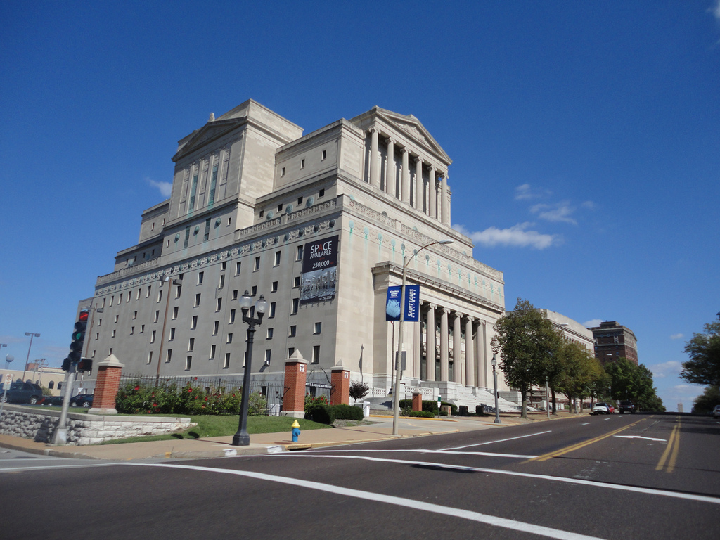
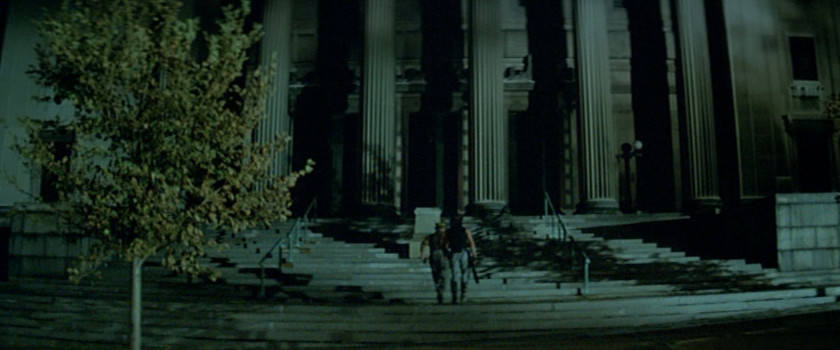
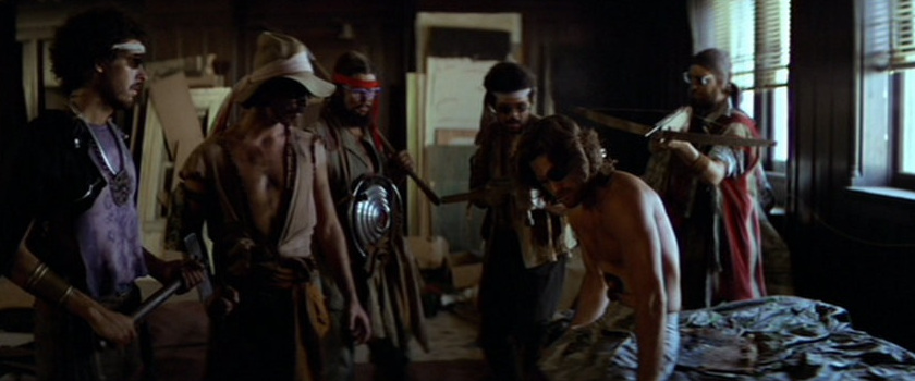
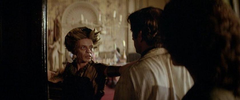
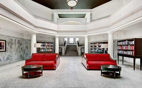
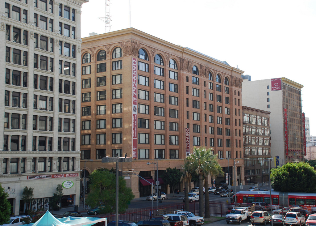
New York Public Library (Entrance) (The New Masonic Temple of St. Louis, St. Louis, MO) (Street View)
Description: The New Masonic Temple is a historic building in St. Louis, Missouri, built in 1926. Like many other buildings built for Freemason meeting places, it shows Classical Revival architecture.
Named a city landmark in 1976, the more than 386,000-square-foot building stands 185 feet high and has more than six million cubic feet of space. There are 14 levels with six full floor and eight mezzanine levels. The Temple's ground was broken in 1923 and dedicated in 1926. Created by well-known architectural company Eames & Young with consulting architect Albert Groves, it features classic Greek Ionic style exterior architecture with various styles throughout the interior.
The Masonic Temple is built in three receding stages, which is symbolic of the three steps in Masonry. Constructed of Bedford limestone with gray granite trim, the main lobby is finished in marble with other rooms featuring its original wool carpet. One of the property's many highlights is an unfinished theater with 2,200 seats.
The lobby has a 38-foot mural titled "The Origins of Freemasonry", which was created in 1941 by Jessie Housley Holliman and dedicated by Senator Harry S. Truman. It is the only surviving mural by noted African American artist Holliman in a St. Louis public building.
The Temple's history includes many prominent guests. It houses the former office of then-Senator and Free Mason Grand Master Harry S. Truman prior to his being President of the United States. Charles A. Lindbergh was initiated and participated as a mason at the Temple prior to his renowned 1927 flight. In 1980, Escape from New York with Ernest Borgnine filmed a scene on the Temple's steps. Borgnine, a mason, attended masonic meetings in the building.
Ground and first floors and first floor mezzanine contain areas where the general public is admitted only on days when a meeting is held, which is currently 10 per month. The second floor contains the Eastern Star quarters. Third and fourth floors and their mezzanines were designed to house the Blue Lodges with the potential for eight Blue Lodge halls. The four halls and the fourth floor were not completed, and one area on the third floor was made into a dining room.
Fifth and sixth floors were designed to house three of the York Rite organizations, which are known as the Chapter, Council and the Commandery. Most of the building is non-sectarian, but the fifth floor features Christian symbolism. The fifth level hall is 100' long, 75' wide and 48' high.
3681 Lindell Blvd
St. Louis, MO 63108
http://www.newtemple.blogspot.com/
http://www.builtstlouis.net/midtown/02a.html
https://en.wikipedia.org/wiki/New Masonic Temple (St. Louis)
Street (Caravan) (Lucas Ave. 16 St., St. Louis, MO) (Street View)
Street (Station Wagon) (N. 17th St. btw Washington Ave. and St. Charles St., St. Louis, MO) (Street View)
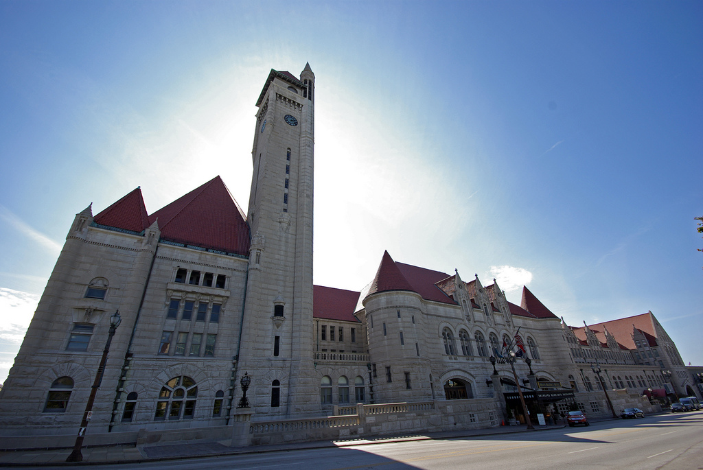
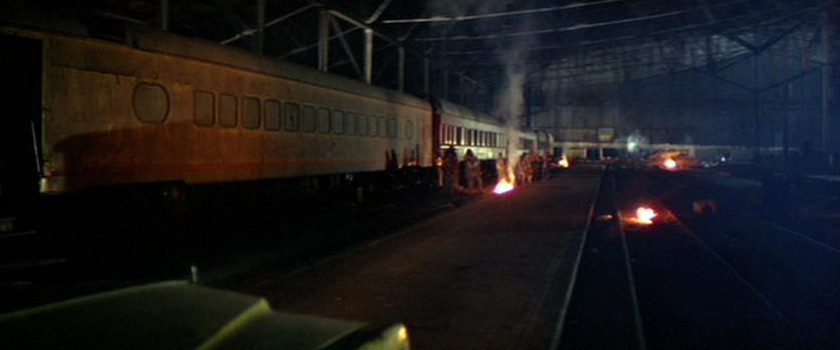
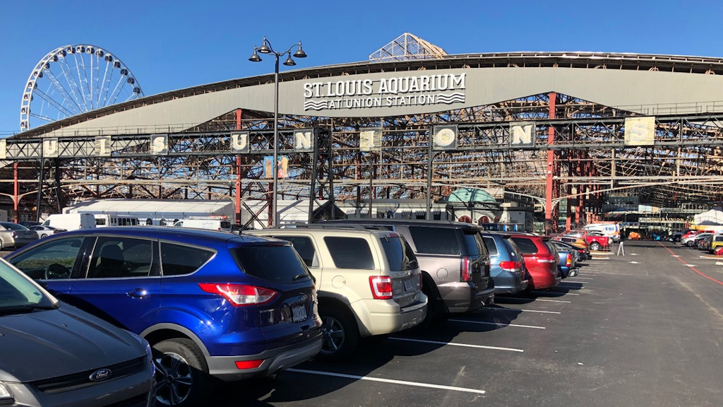
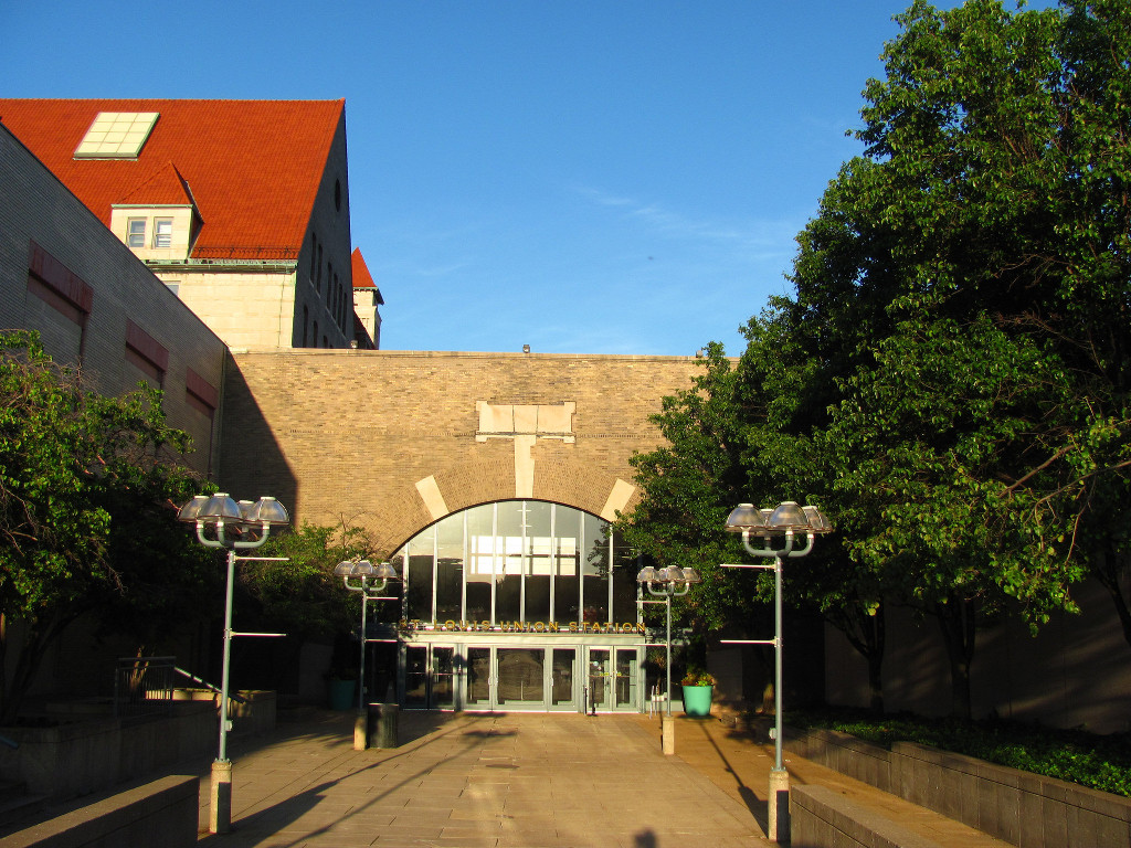
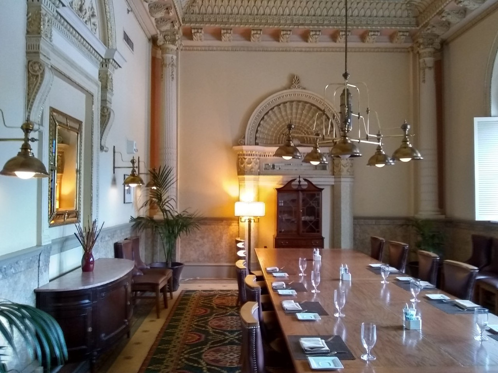
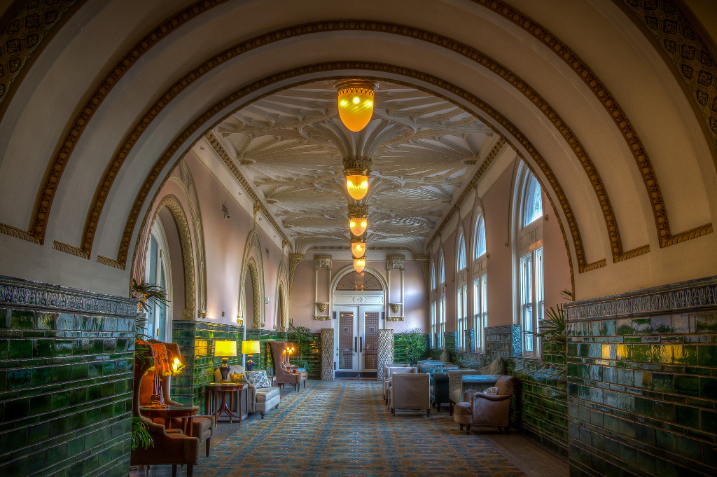
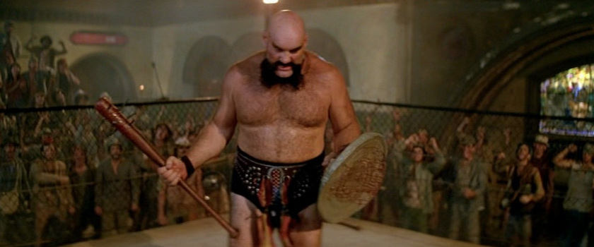
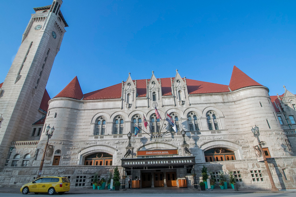
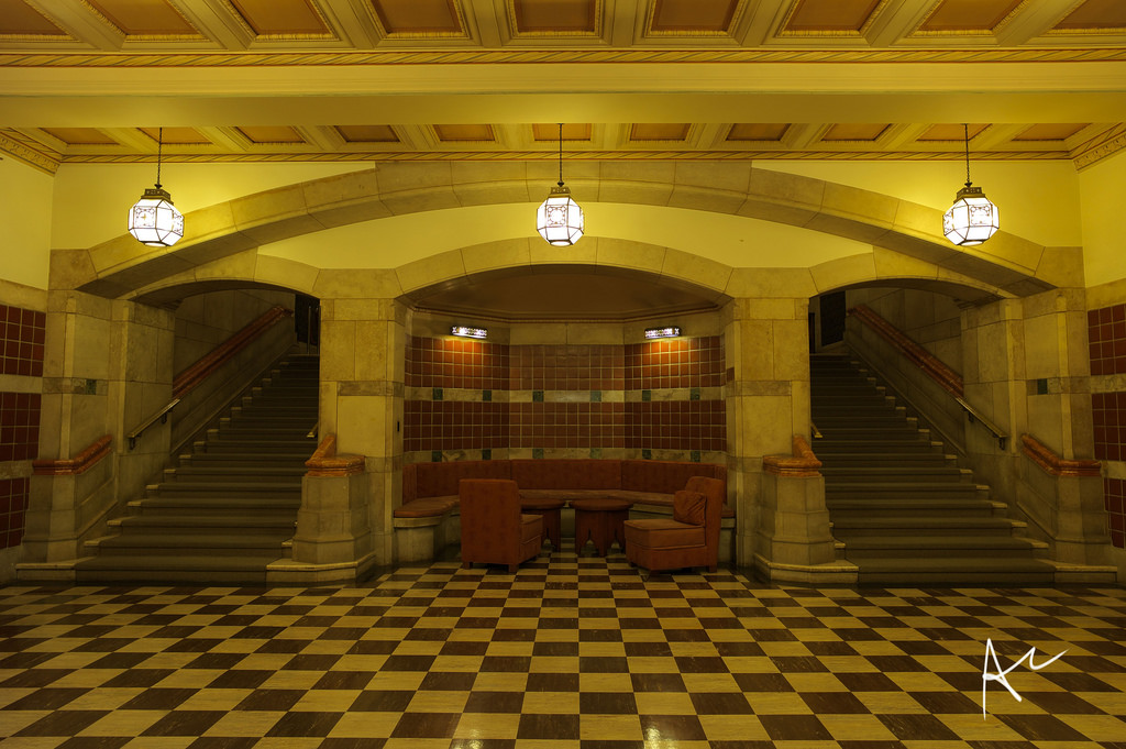
Grand Central Station (St. Louis Union Station, St. Louis, MO) (Street View)
Description: From its magnificent 65-foot, barrel-vaulted ceiling in the Grand Hall to its Victorian-engineered train shed totaling more than 11 acres, St. Louis Union Station remains one of our nation's true architectural "gems." Built at a cost of $6.5 million in the 1890s St. Louis Union Station was designed by German-born architect Theodore C. Link of St. Louis who won the prized project in a nationwide contest. It was once the busiest and largest passenger rail terminal in the world. It's operation ceased in 1978 and in the early 1980s, the Station underwent a $150 million restoration. It was reopened 1985 as the largest adaptive re-use project in the U.S. housing a 539 room Hyatt Regency Hotel (St. Louis Union Station Hotel, Curio Collection by Hilton), a 10-screen movie theater, luxury offices, a lake, four active train tracks and a plaza for festivals, concerts and other special events. St. Louis Union Station consists of three main areas: The Head house, Midway and Train Shed.
 >
>
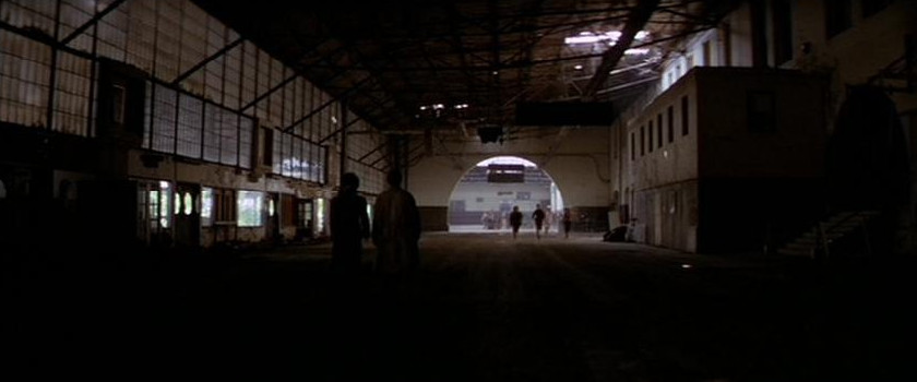
Grand Central Station (Rear Entrance) (Old St. Louis Union Station Train Station, The Train Shed)
Description: 11.5 acres of sweeping arches, was the largest single-span train shed ever constructed. It once covered the greatest number of train tracks (32) than any other station in the nation. Measuring 606 feet wide by 810 feet long, the Victorian-engineered shed soars to 140 feet with its massive space divided by five structural bays. The Shed currently houses retail and restaurant facilities, a portion of the Marriott Hotel (St. Louis Union Station Hotel, Curio Collection by Hilton), the lake, event and parking areas.
 >
>
 >
>
 >
>
 (Street
View)
(Street
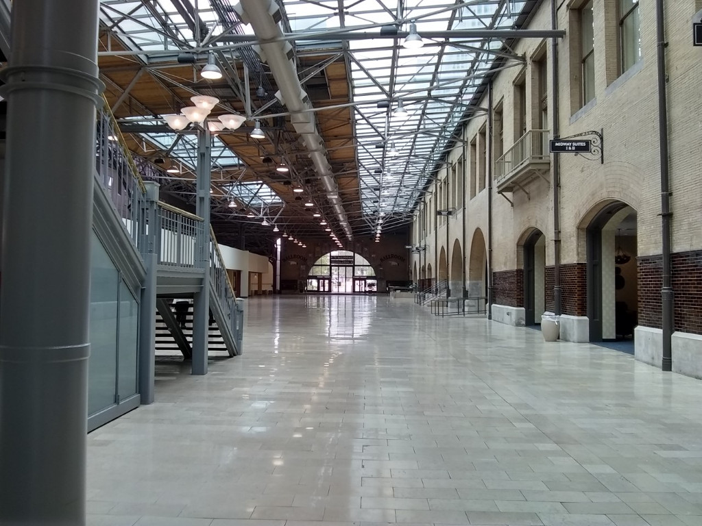
View)Grand Central Station (Hall) (Old St. Louis Union Station Gathering Space, The Midway between Union Station and Marriott Hotel, Hyatt Regency, DoubleTree By Hilton, St. Louis Union Station Hotel, Curio Collection by Hilton, Stairway West Hall)
Description: The Midway, once serviced more than 100,000 rail passengers a day. The 610-foot-long and 70-foot-wide concourse was connected to the massive Train Shed, where passengers lined up to board trains through one of 32 boarding gates. The Midway was constructed with a light steel trussed roof of glass and iron. Today it serves as a passageway filled with an array of shops and restaurants.
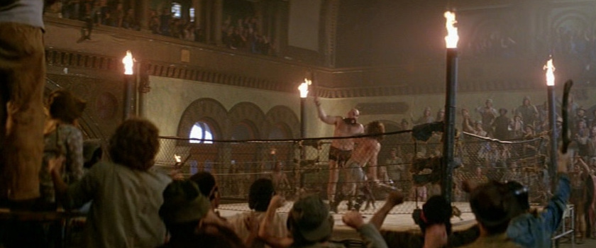
Comment (Andreas/Webmaster): "The area where The Duke is target practicing at The President has been demolished and turned into a St. Louis Union Station entrance."
 >
>
 >
>
 >
>
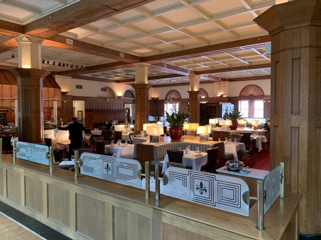
Grand Central Station (Wrecked Dining Room) (St. Louis Union Station former Harvey House restaurant area, Marriott Hotel, Hyatt Regency, DoubleTree By Hilton, St. Louis Union Station Hotel, Curio Collection by Hilton, The Station Grille/The Link Room)
Comment (Temple Looper): "I got chills in the room where they kept the President. It's called The Link Room (Private room) named after the building's architect (Theodore Link). He ate all his meals in there."
 >
>
Grand Central Station (Hallway) (St. Louis Union Station Grand Hall, Marriott Hotel, Hyatt Regency, DoubleTree By Hilton, St. Louis Union Station Hotel, Curio Collection by Hilton Restaurant Hallway/Lobby)
 >
>
 >
>
 >
>
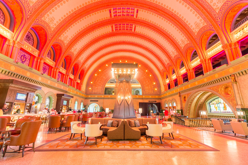
Grand Central Station (Lobby) (St. Louis Union Station Grand Hall, Marriott Hotel, Hyatt Regency, DoubleTree By Hilton, St. Louis Union Station Hotel, Curio Collection by Hilton Lobby)
 >
>
Grand Central Station (Entrance) (Deleted Scenes) (St. Louis Union Station Entrance, Marriott Hotel, Hyatt Regency, DoubleTree By Hilton, St. Louis Union Station Hotel, Curio Collection by Hilton Entrance) (Street View)
Description: Within sweeping archways, fresco and gold leaf detailing, mosaics and glass windows, you will find the St. Louis Union Station Hotel, Curio Collection by Hilton. Our AAA Four Diamond Hotel provides a truly elegant experience in the heart of a bustling metropolitan area. Transport yourself to a time when travel was an art and the fine details were important.
Every guest room boasts timeless décor, a work area, a flat screen TV and spacious bathroom. Opt for a suite with a courtyard view, concierge lounge access and added amenities. Several of our suites offer exclusive access on the historical side of the building and are individually railroad themed.
Dining is a unique experience at our Union Station hotel with offerings ranging from upscale American cuisine to a quick sandwich or pastry. Savor delicious breakfast, lunch and dinner at the Station Grille with lovely fountain views. Stop by the Grand Hall Market for your morning Starbucks coffee and grab a local treat or souvenir.
After a busy day in St. Louis, unwind with one of our many hotel amenities. Workout in the fitness center, swim some laps in the outdoor seasonal pool and revel in The Grand Hall Experience 3D Light Show. Plan your next St. Louis event in our 100,000 sq. ft. of flexible space for up to 2,000 people. Our unique venue, on-site event staff and catering options make your wedding day as perfect as possible.
1820 Market Street
St. Louis, MO 63103
http://www.stlouisunionstation.com/
http://curiocollection3.hilton.com/en/hotels/missouri/st-louis-union-station-hotel-curio-collection-by-hilton-STLCUQQ/index.html
http://www.grandhall-stl.com/
https://en.wikipedia.org/wiki/Union Station (St. Louis)
Photo Credit: Temple Looper (3, 6)
 >
>
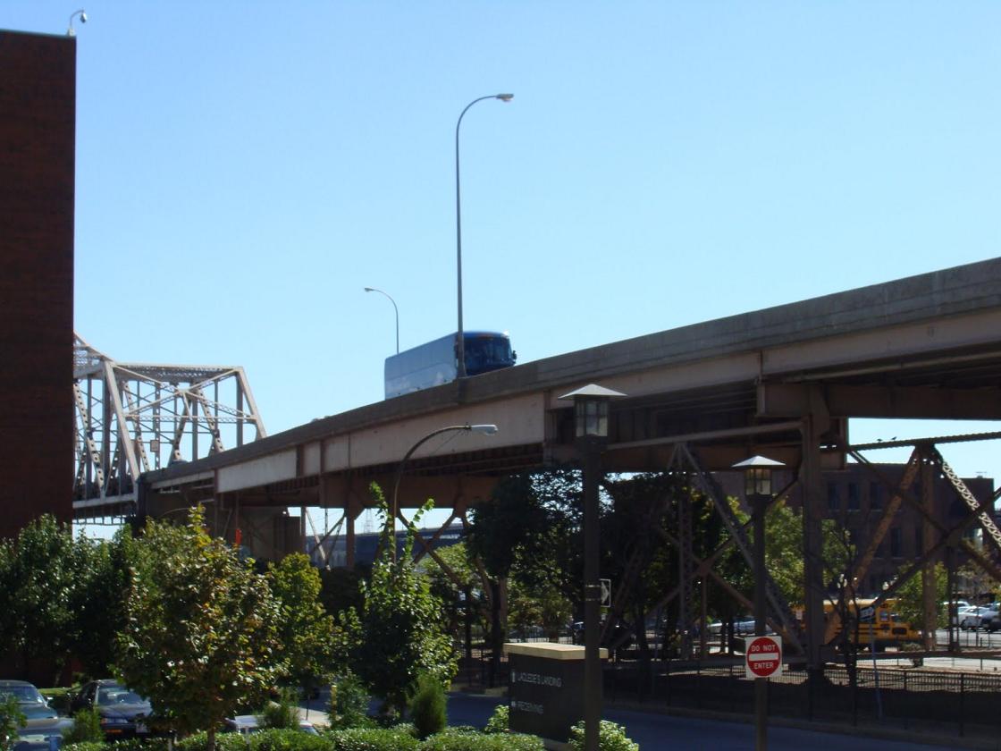
69th Street Bridge (Entrance) (North side of the Martin Luther King Bridge/N. 2nd St./Doctor M.L.K. Dr, St. Louis, MO) (Laclede's Landing) (Street View)
Description: Located on the banks of the mighty Mississippi River and just north of the world-famous Gateway Arch, Laclede's Landing is downtown St. Louis’ oldest district and ONLY riverfront entertainment and dining destination. This nine-block area – once the manufacturing, warehousing and shipping hub of St. Louis – is now home to over twenty great restaurants, clubs, shops and attractions.
Comment (Andreas/Webmaster): "The Martin Luther King Bridge was renovated in the late 80s and the tunnel that The Duke drives through has been removed."
http://lacledeslanding.com/
http://en.wikipedia.org/wiki/Martin Luther King Bridge (St. Louis)
 >
>
 (Satellite
View)
>
(Satellite
View)
>
 >
>
 (Street
View)
>
(Street
View)
>
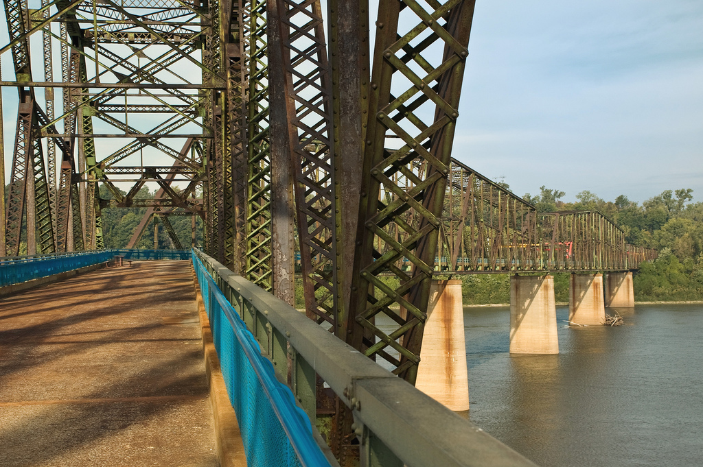
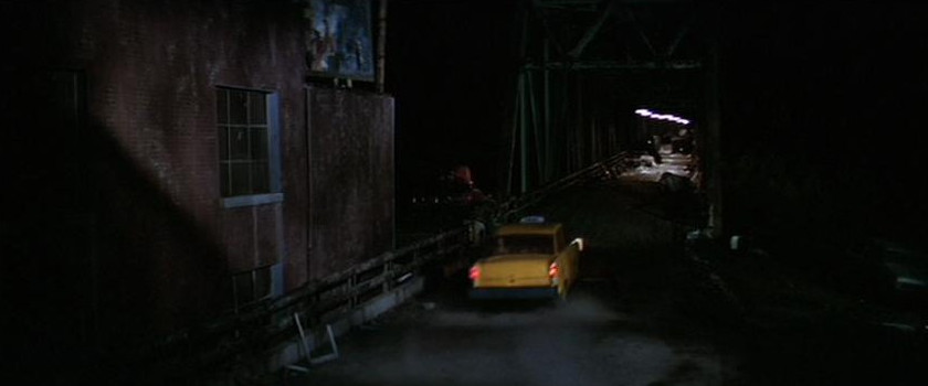
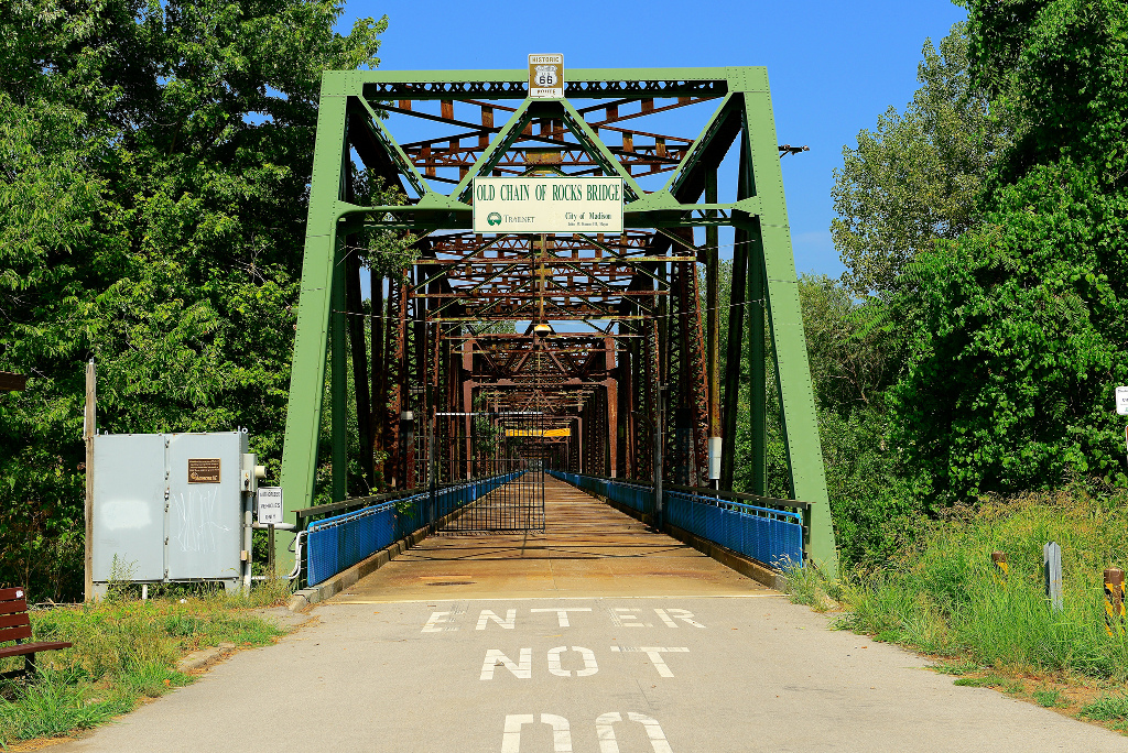
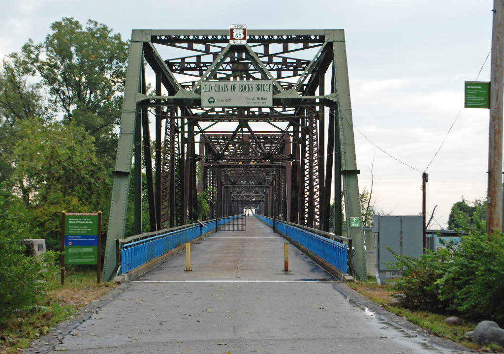
69th Street Bridge (Old Chain Of Rocks Bridge, St. Louis. MO) (Street Bridge)
Description: The Old Chain of Rocks Bridge spans the Mississippi River on the north edge of St. Louis, Missouri. The eastern end of the bridge is on Chouteau Island, (part of Madison, Illinois), while the western end is on the Missouri shoreline. It was the most famous of the Route 66 crossings of the Mississippi River. It was deemed as unsafe for daily heavy traffic and closed in 1970. For nearly three decades the fate of the bridge was uncertain. During this time, the bridge developed a reputation for crime and violence, including the April 1991 murder of sisters Julie and Robin Kerry. In 1998, the bridge was leased to Trailnet, a local trails group, to operate. Four and a half million dollars have been spent on renovating the bridge for pedestrian and cycling use. The blue side fencing was added to the bridge for safety when the bridge became a pedestrian bridge. It is also famous for its 22 degree bend in the middle of the bridge.
Riverview Dr./St. Louis Riverview Trail
St. Louis, MO
http://trailnet.org/
http://www.builtstlouis.net/industrial/chain-of-rocks-bridge.html
https://en.wikipedia.org/wiki/Chain of Rocks Bridge
California
 >
>
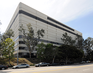
Bank Of The United States Colorado Federal Reserve (Deleted Scenes) (Former Bank of America Data Processing Center, Vault, Los Angeles, CA) (Street View)
Description: The City Planning department is reviewing plans from developer G.H. Palmer Associates for Ferrante, which would create approximately 1,500 apartments and 30,000 square feet of ground-floor retail space on a 9,6-acre plot at 1000 W. Temple St. The site, along the western edge of the 110 Freeway and across from the Edward R. Roybal Learning Center, currently holds a 10-story office building and a four-floor parking structure that would be demolished. Ferrante would include parking for about 2,600 vehicles and 1,680 bicycles, according to documents filed with City Planning. Like Palmer's other Downtown projects, Ferrante would have numerous indoor and outdoor amenities including rooftop decks and pools. No budget or timeline has been revealed, but the planning filing indicates a 2018 completion.
1000 W Temple St
Los Angeles, CA 90012
https://www.bankofamerica.com/
https://en.wikipedia.org/wiki/Bank of America
 >
>
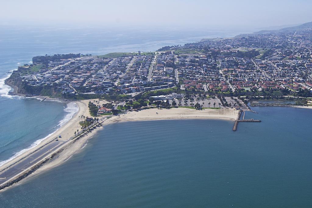
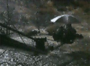
East River (Inner Cabrillo Beach, San Pedro, CA) (Satallite View)
Description: Cabrillo Beach is a historic beach located in San Pedro, Los Angeles, California. It is named after Juan Rodríguez Cabrillo, a Portuguese explorer who was the first to sail up the California coast. Cabrillo has two separate beach areas.
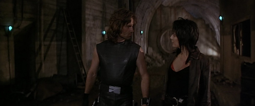
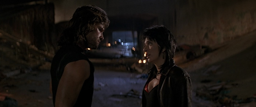
Comment (James Winburn/Stunts) "The location was Cabrillo Beach off Oliver Vicky Way in San Pedro, California. The shot as you know was in the channel with the harbor light in the distant as the two escapee on the raft, trying to escape from the NY Island. The water shot was the last production day of the production shoot. John Carpenter and Dick Warlock didn't know that Debra Hill call me to do this last shot of the film, see how I didn't travel to St Louis with production company.. Politic...
I met Debra Hill as I pull up and park my truck and then Debra and I went to John Carpenter and Dick Warlock, the stunt coordinator. The second stuntman was Mike Johnson, a member of the "Stuntmen's Association of Motion Pictures & Television" same as Dick and I was. We discuss the scene and the various camera angles to get the shot. John Carpenter just wanted a wide angle shot with the helicopter firing the flares.
Mike and I went to SFX coordinator to discuss putting a effect on the raft. The special effects coordinator said, "No Explosion"... He said, effect of raft explosion will be edited in later. We try to discuss the scene structure with Dick Warlock and John Carpenter and John said only effect was the flares being shot from the helicopter.
Camera was placed on the beach and we were tow out into the channel and then the real helicopter flew in.. Effect person shot the flares from the helicopter and the scene was rap... One did hit the raft next to me. Ouchyyyy. Not more than three takes. The editor, edited in the special effects of the explosion and the NY bridge in the back ground as the helicopter flew across the screen.
By the time Mike Johnson and I got back to the shore, the crew was rapping the equipment and trucks were leaving.. It was a nothing shot. Which could've been a great action scene for the opening, if John Carpenter wanted to put more time into it. But that all history..."
3720 Stephen M. White Dr.
San Pedro, CA 90731
http://www.laparks.org/dos/aquatic/facility/cabrillobeachpool.htm
https://en.wikipedia.org/wiki/Cabrillo Beach
 >
>
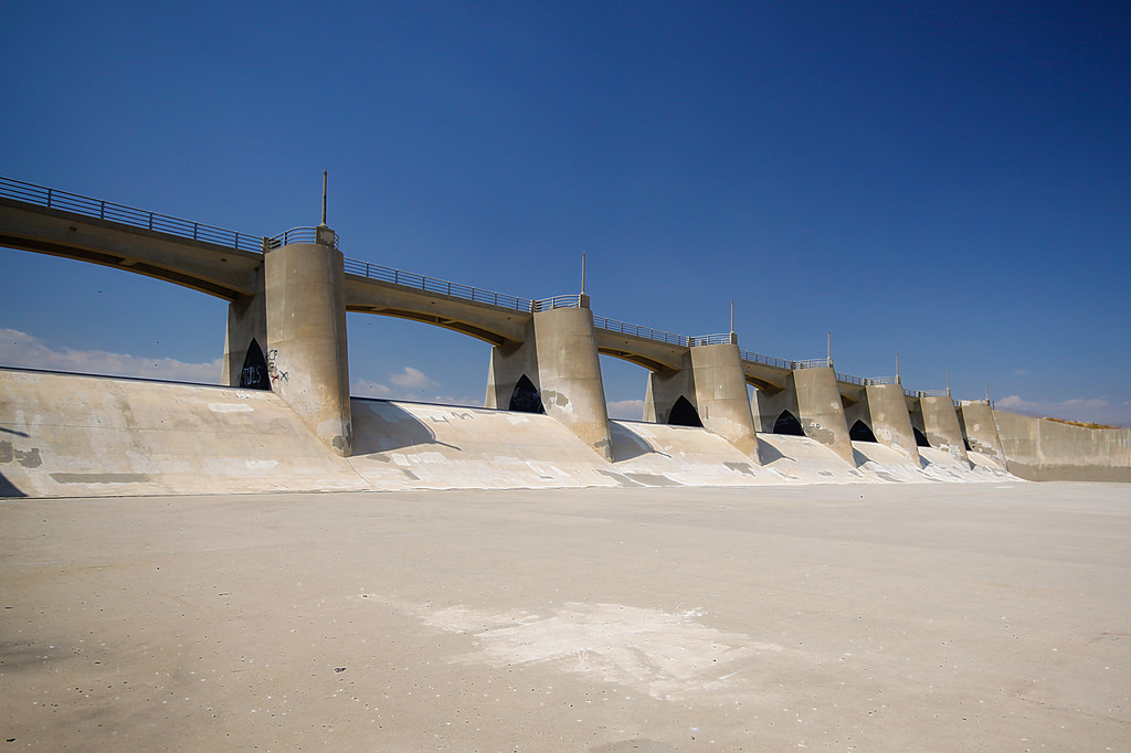
Liberty Island Security Control/Central Park (Sepulveda Dam Flood Control Basin, San Fernando Valley, CA) (Street View)
Description: The Sepulveda Dam is a project of the U.S. Army Corps of Engineers designed to withhold winter flood waters along the Los Angeles River. Completed in 1941, at a cost of $6,650,561, it is located south of center in the San Fernando Valley, approximately eight miles east of the river's source in the western end of the Valley, in Los Angeles, California.
Sepulveda Dam, along with Hansen Dam located in the north San Fernando Valley, was constructed in response to the historic 1938 floods which killed 144 people. Sepulveda Dam was placed at what was at the time, the current edge of the city. East of the dam the river was crowded into a narrow bottom by the city's growth. One legacy of Sepulveda Dam is its flood control basin, a large and undeveloped area in the center of the Valley, used mostly for wildlife refuge and recreation. But another legacy of the 1938 Los Angeles River flood was the post-WWII channelization of all the Valley's dry washes, which along with the post-WWII rapid suburbanization left the Valley with hot, dry, concrete-lined river bottoms instead of greenbelts. Although now, in part, these are being devolved as interconnecting bike paths.
Behind the dam, the Sepulveda Basin is home to several large recreation areas including Woodley Park, a model aircraft field, The Japanese Garden, a wildlife refuge, a water reclamation plant, and an armory. The Basin is kept free of urban over-building so that water can build up there during a prospective hundred-year flood.
It is an often-used location for car commercials.
N. W. junction of the 101 Hollywood/Ventura Fwy and the 405 San Diego Fwy
San Fernando Valley, CA
http://en.wikipedia.org/wiki/Sepulveda Dam
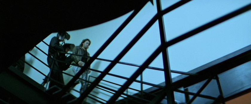
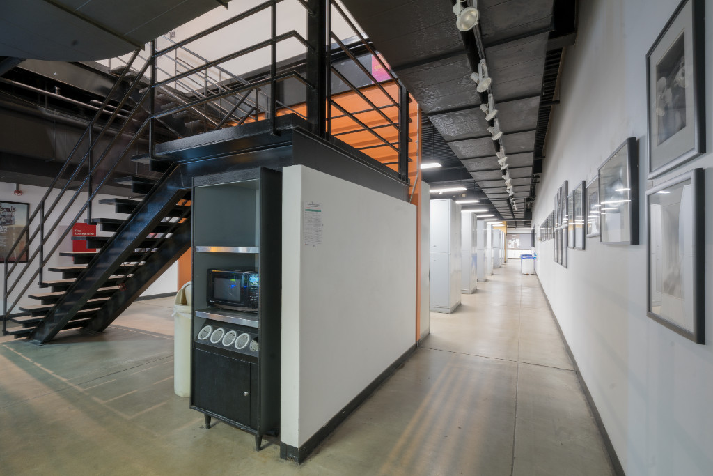
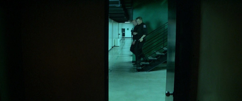
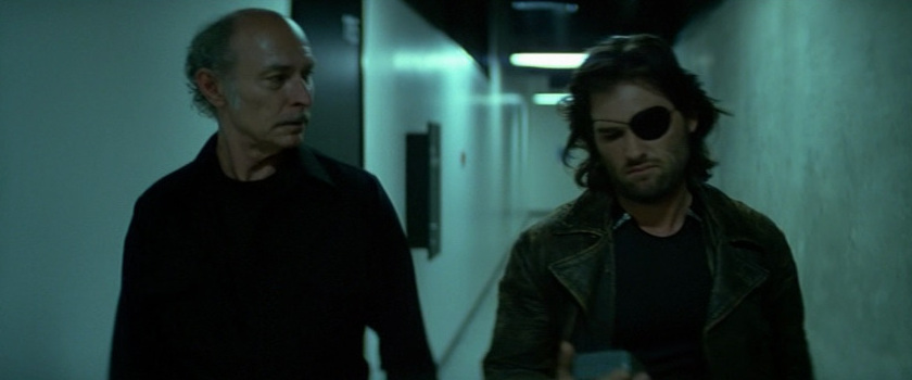
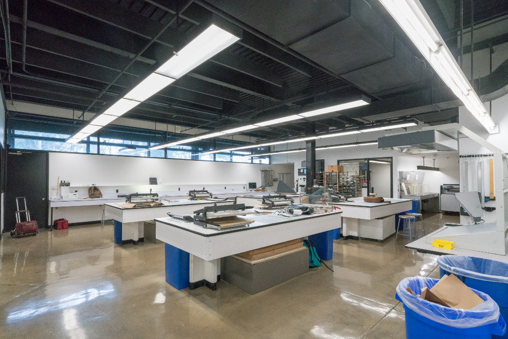
Liberty Island Security Control (Bunker) (Art Center College of Design, Hillside Campus, Photo Department Areas, Pasadena, CA) (Street View)
Description: Art Center College of Design has been a leader in art and design education for nearly 75 years. The College offers undergraduate and graduate degrees in a wide range of disciplines, as well as Public Programs offering design education to all ages and levels of experience.
 >
>
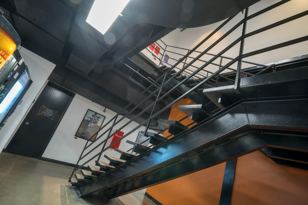
Stairway (North Stairway)
 >
>
>
>
 >
>
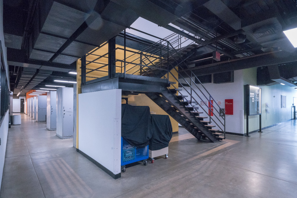
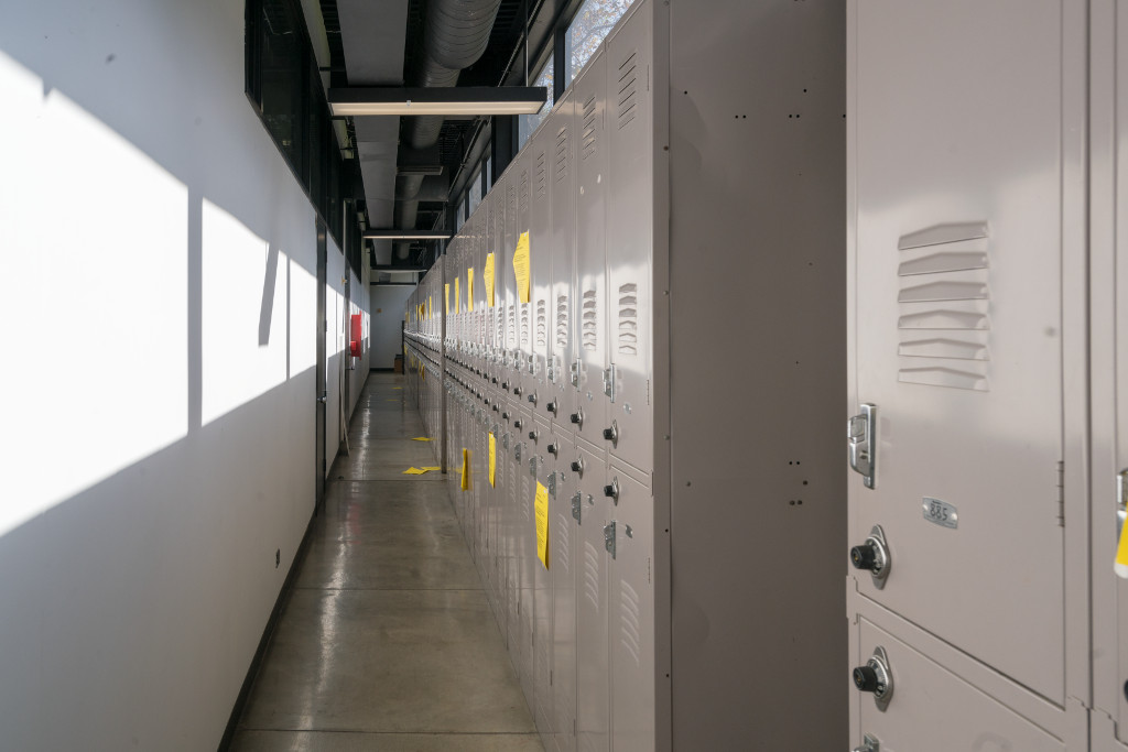
Debarkation Area (Locker Hallway)
 >
>
Processing Area (Photo Office)
 >
>
>
>
 >
>
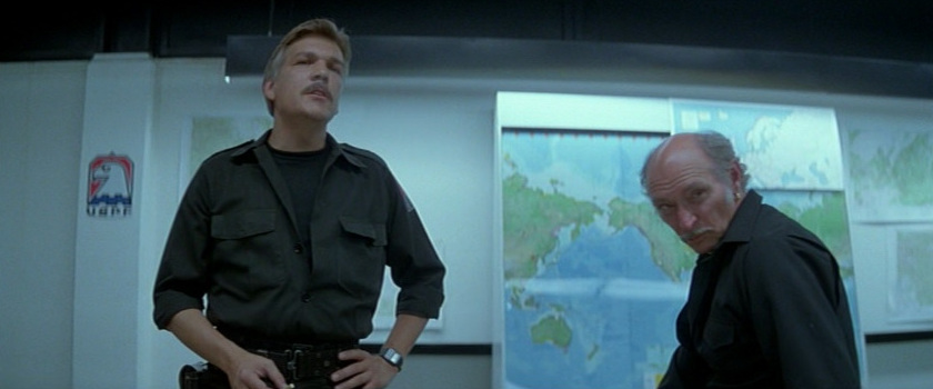
Air Traffic Room (Room 119)
 >
>
 >
>
 >
>
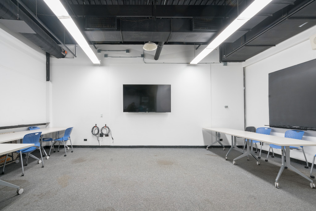
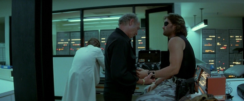
Control/Conference Room (Film Stage)
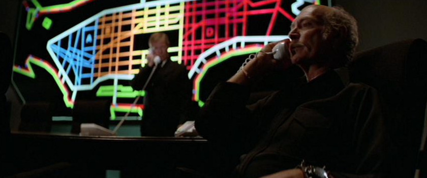
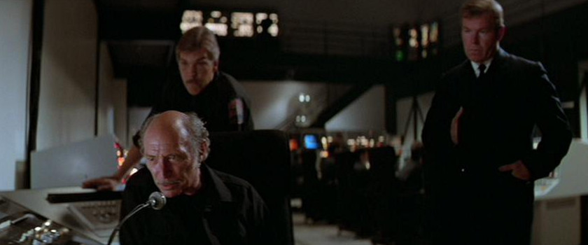
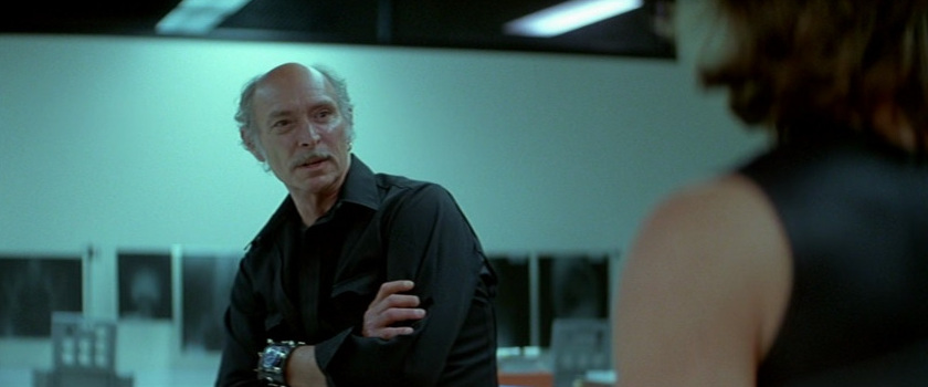
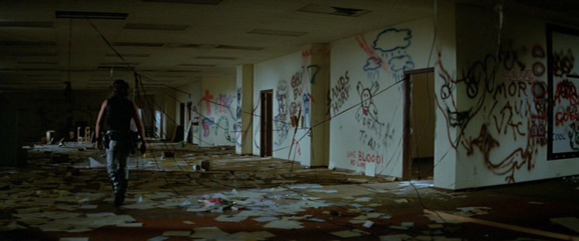
Hauk's Office (Room 215/Demolished)
 >
>
 >
>
 >
>
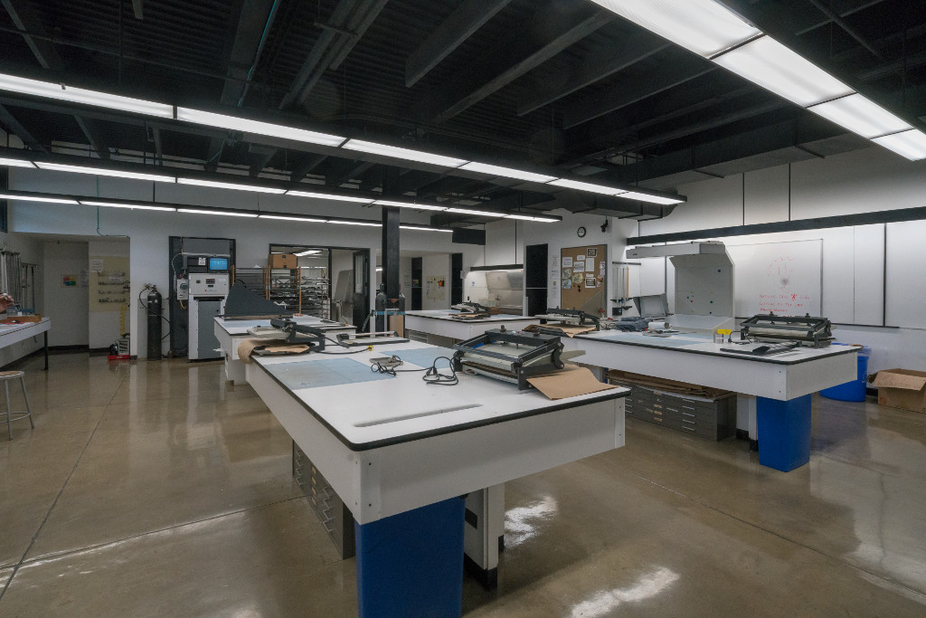
Storage Room (Room 116)
 >
>
 >
>
 >
>
Hallway (Lower Hallway)
 >
>
 >
>
 >
>
Examination Room (Black and White Lab)
1700 Lida Street
Pasadena, CA 91103
http://www.artcenter.edu
https://en.wikipedia.org/wiki/Art Center College of Design
Photo Credit: Yongmei Wang (Rose) (1-6, 9-14)/Yan Da (7-8)
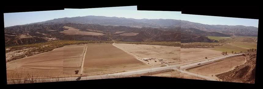
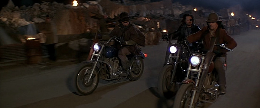
Bank Of The United States Colorado Federal Reserve (Roof Top) (Deleted Scenes)/Airstrip/World Trade Center (Roof Top)/Chock full o'Nuts (Indian Dunes, Valencia, CA) (Street View)
Description (Indian Dunes): Was used for motorcycle dirt biking between 1970-1985. Many movies were also shot here. It featured two motocross tracks, one called the International the other Shadow Glen. There was also a flat track and a mini bike track. The very first World Mini Bike Grand Prix was held at the Dunes.
Description (Indian Dunes Airfield): Opened sometime in the '60s. It was used to film numerous aviation-related scenes for television shows and movies. Some of these include: The Black Sheep Squadron, Escape From New York, China Beach, and others. The last scenes to be filmed here were those from The Rocketeer in 1989. The field closed sometime thereafter. The tragic Twilight Zone: The Movie (1983) helicopter crash which killed the pilot and two child actors aboard occurred in nearby Indian Dunes Park. The field is now owned by a development company (Newhall Land & Farming Company) and is slated to become homes.
Bank Of The United States Colorado Federal Reserve (Roof Top) (Deleted Scenes) (Locations, pictures and info: Prop Sets at the Dunes (PDF) By Tom Higginson)
Airstrip (Locations, pictures and info: Prop Sets at the Dunes (PDF) By Tom Higginson)
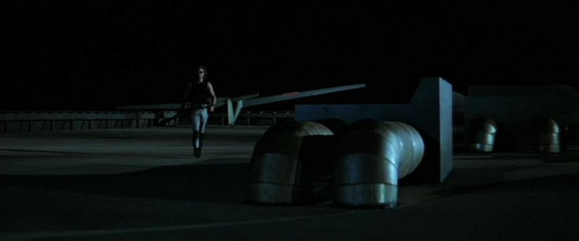
Comment (Stephen Manley): "The runway used when Snake is entering the glider and taking off was also used in the 1980 film The Stunt Man with Peter O'Toole. The same runway shot from the same angle a year before can be seen in the "wing walking" scene during the daylight: desert hills and all."
World Trade Center (Roof Top) (Locations, pictures and info: Prop Sets at the Dunes (PFD) By Tom Higginson)
Comment (Tom Higginson): "The glider actually landed on a square patch of asphalt that was built in the center of the large hardball oval track just a few dozen feet south of the runway; he didn't actually land on the runway."

Chock full o'Nuts (Locations, pictures and info: Prop Sets at the Dunes (PDF) By Tom Higginson)
Comment (Weldon Sipe): "The brick blind alley was at the west (right) end of the building. On the building side it formed the exterior wall of the set. The other side was (and rear) were 2x4's and unfinished on the other sides. The telephone pole and window that "Snake" used were practical, and inside the window was a small area that supported a little action scene and reverse camera angles toward the window. The south side (facing Grapevine Mesa) was unfinished, but there may have been one flat leading from the rear door to prevent seeing the woods of shadow glen track as the director was then not totally limited from seeing actors come out the rear. The subway entrance on the front of the building was filled in by my construction workers as I recall, being too dangerous to leave open because of the motor cycles. There weren't many shoots that focused on the set per se, most used it as a background only."
Comment (Tom Higginson): "The "Chock full o'Nuts" set remained standing at Indian Dunes well into the 1980s and the balcony Snake climbs up into and kicks in the window to get in can be seen in the background in this shot from the 1985 Airwolf episode Dambreakers. The set wasn't torn down because Weldon Sipe who was the land manager for all film and television work at the time over at Newhall's (Indian Dunes) had a gentleman's agreement with production fellas. In a nutshell, if a production left a set or partial set behind at Indian Dunes that could get some use later, Weldon would ensure that they got a reduced rate for filming on the property."

Uranus - Lonely Streetfighter (1983)
California 126 Highway, Henry Mayo Dr, Seasoned Road/Wolcott Way
Valencia, CA
http://www.thefasthouse.com/when-rules-were-few/indian-dunes-classic
http://members.tripod.com/airfields freeman/CA/Airfields CA SanFernan.htm
Photo Credit: Tom Higginson
 >
>
 >
>
World Trade Center (50th Floor) (Getty Oil Building, The Mercury, Second Floor, UDream Dental, Los Angeles, CA) (Street View)
Description: The former Wilshire at Western Building was the home of the Getty Oil Company. It was a 23 stories tall derelict office building for many years and it always had "for lease" signs on it. It went vacant in the mid 90s. Then a condo conversion project transformed the building in 2005-2006.
3810 Wilshire Blvd
Los Angeles, CA 90010
http://themercurycondos.com/
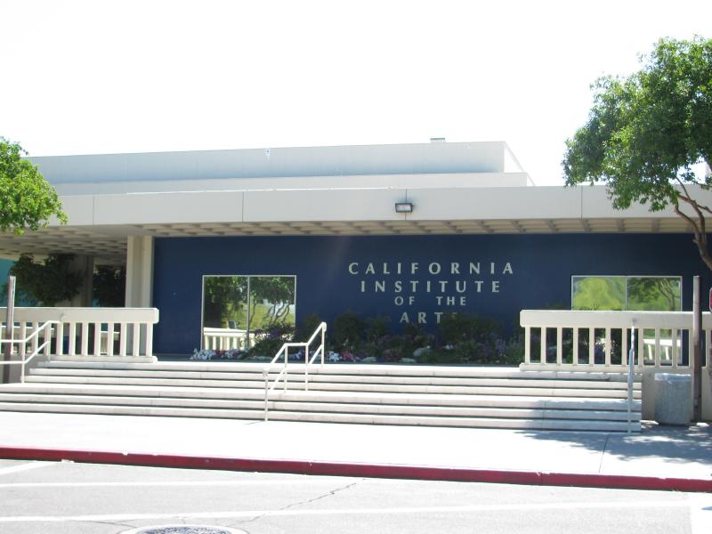
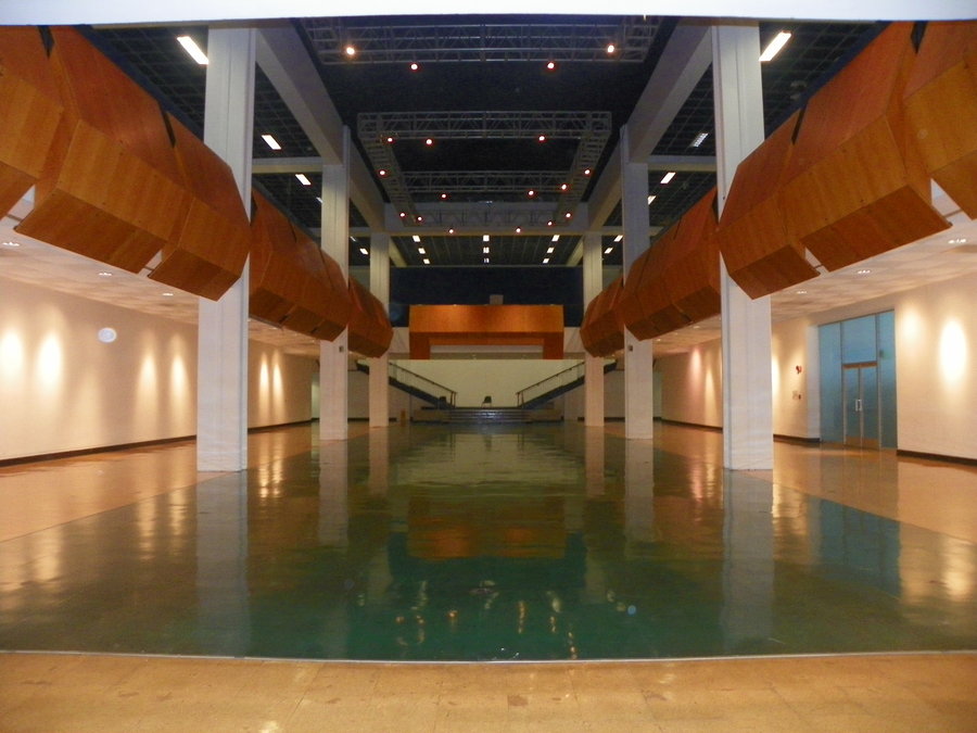
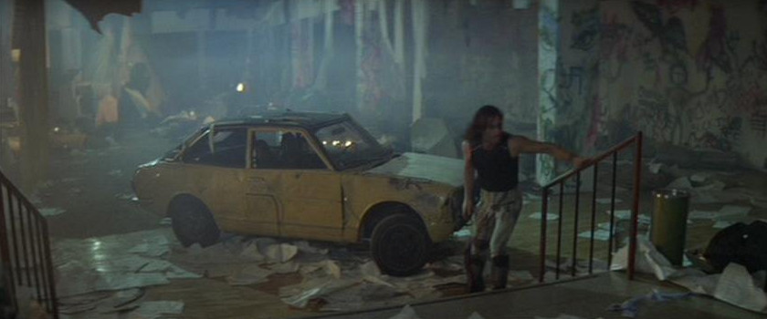
World Trade Center (Lobby)/World Trade Center (Stairwell) (Deleted Scenes) (CalArts, California Institute of the Arts, Valencia, CA) (Satellite View)
Description: CalArts is the first U.S. higher educational institution to offer undergraduate and graduate degrees in both visual and performing arts. It was established in 1961 by Walt and Roy Disney through the merger of two professional schools, the Los Angeles Conservatory of Music, founded in 1883, and the Chouinard Art Institute, founded in 1921. CalArts moved to its permanent home in Valencia in 1971 and added degree programs in dance, film and theater to those in art and music.
 >
>
 >
>
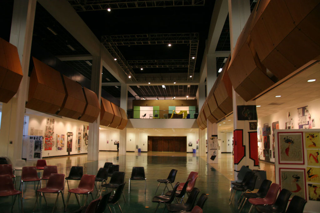
World Trade Center (Lobby) (Main Gallery)
 >
>
World Trade Center (Stairwell) (Deleted Scenes) (Character Animation Department Right-Hand Stairwell)
24700 McBean Pkwy
Valencia, CA 91355
http://www.calarts.edu/
https://en.wikipedia.org/wiki/California Institute of the Arts
Photo Credit: Thomas Sclafani (3)
 (Deleted Scenes)
>
(Deleted Scenes)
>
 >
>
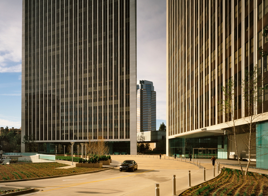
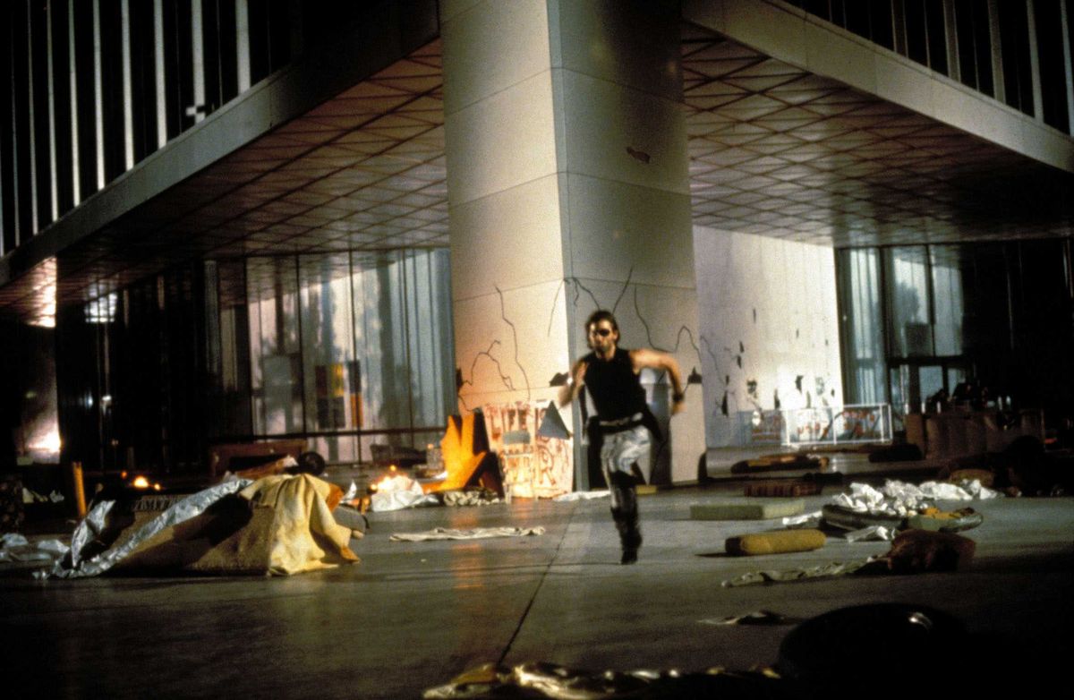
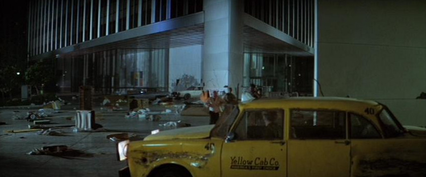
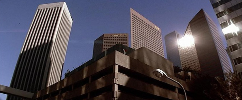
World Trade Center (Entrance) (Century Plaza Towers, 2049, Century City, Los Angeles, CA) (Street View)
Description: Century Plaza Towers I and II are two 44-story, 571 feet (174 m) tall twin towers located at 2029 and 2049 Century Park East in Century City in Los Angeles, California. Commissioned by Alcoa the towers were completed in 1975 and designed by Minoru Yamasaki. The towers resemble his World Trade Center in their vertical black and gray lines and use of aluminum exteriors. The towers have a somewhat unique triangular footprint and are landmarks that are clearly seen around the Los Angeles Westside. Their prominence in the Century City skyline has been reduced in recent years with the addition of new skyscrapers that partially block their view. Nevertheless, the Century Plaza Towers remain the tallest buildings in Century City and the tallest skyscrapers in Southern California outside of downtown Los Angeles. The towers sit on top of one of the world's largest underground parking garages.
2029 and 2049 Century Park East
Century City, Los Angeles, CA 90067
http:www.centurypark.net/centuryplazatowers/index.html
https://en.wikipedia.org/wiki/Century Plaza Towers
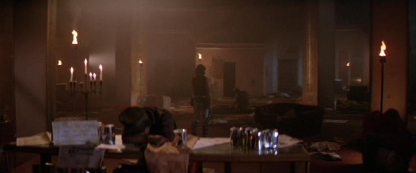
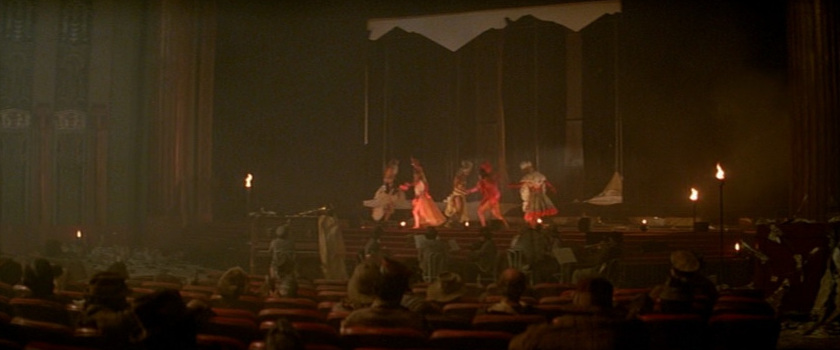
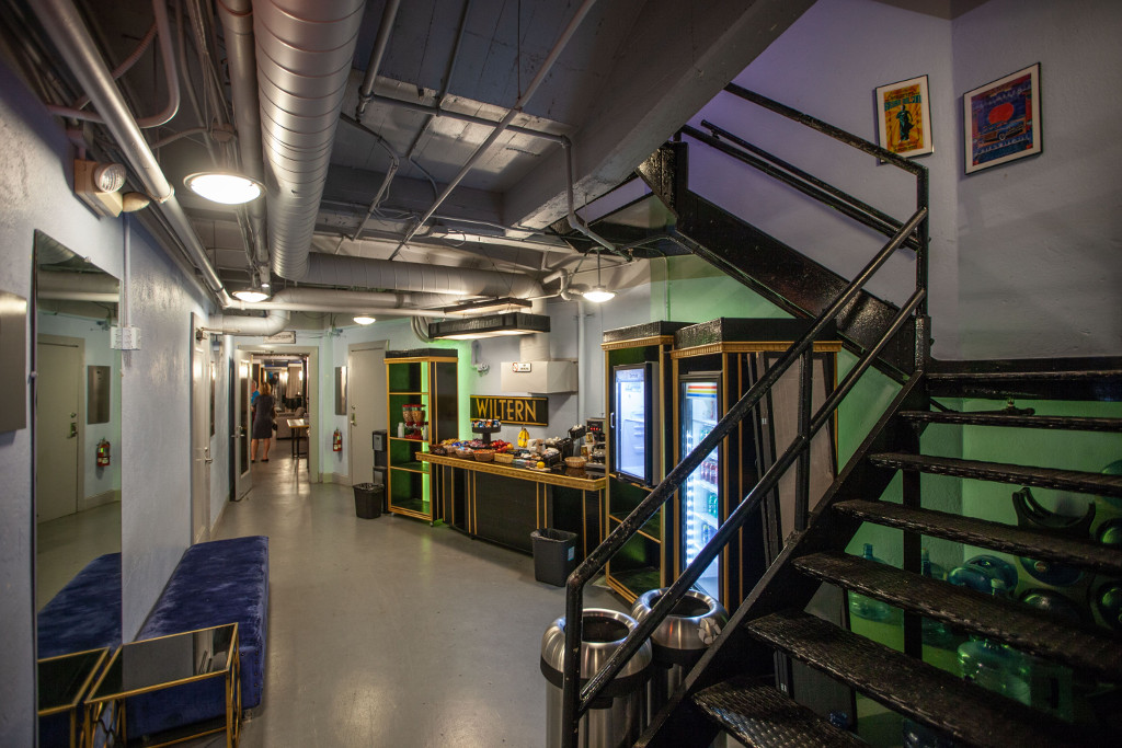
Theater (Wiltern Theatre, Los Angeles, CA) (Street View)
Description: The Wiltern Theatre and adjacent 12-story Pellissier Building are Art Deco architectural landmarks located on the corner of Wilshire Boulevard and Western Avenue in Los Angeles, California. The entire complex is commonly referred to as the Wiltern Center. Clad in a blue-green glazed architectural terra-cotta tile and situated on a diagonal to the street corner, the complex is considered one of the finest examples of Art Deco style architecture in the United States. The Wiltern building is owned privately and the Wiltern Theatre is operated by Live Nation's Los Angeles division and is a well established landmark in Los Angeles. The historic Wiltern Theater originally opened on 7 October 1931 and was later sold to an insurance company in 1956 who ignored it till the late 70s. It was in a bad shape and was saved by a local group of preservationists from being demolished on two occasions. A developer called Wayne Ratkovich later purchased it in 1981 to restore the theater and office building. The renovation of the The Wiltern Theater was complete by 1985. It is currently used for a large variety of events including: rock/pop concerts, dance performances, award shows, television tapings, stage productions, and corporate events.
 >
>
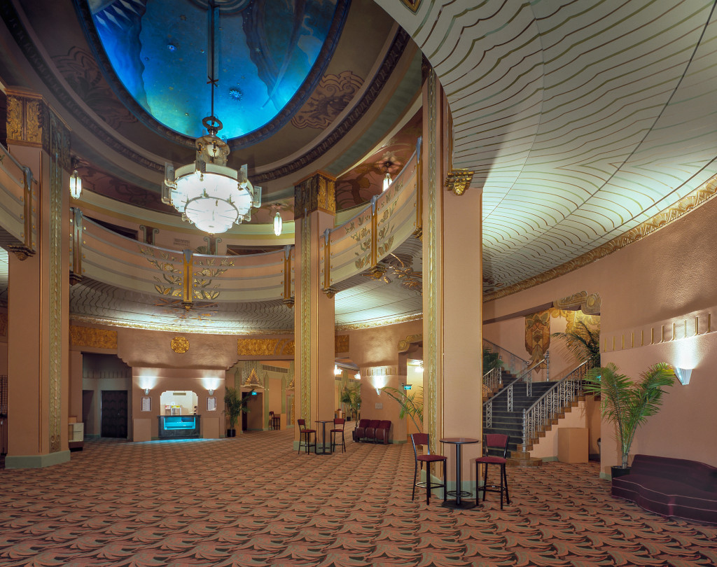
Lobby (Lobby)
 >
>
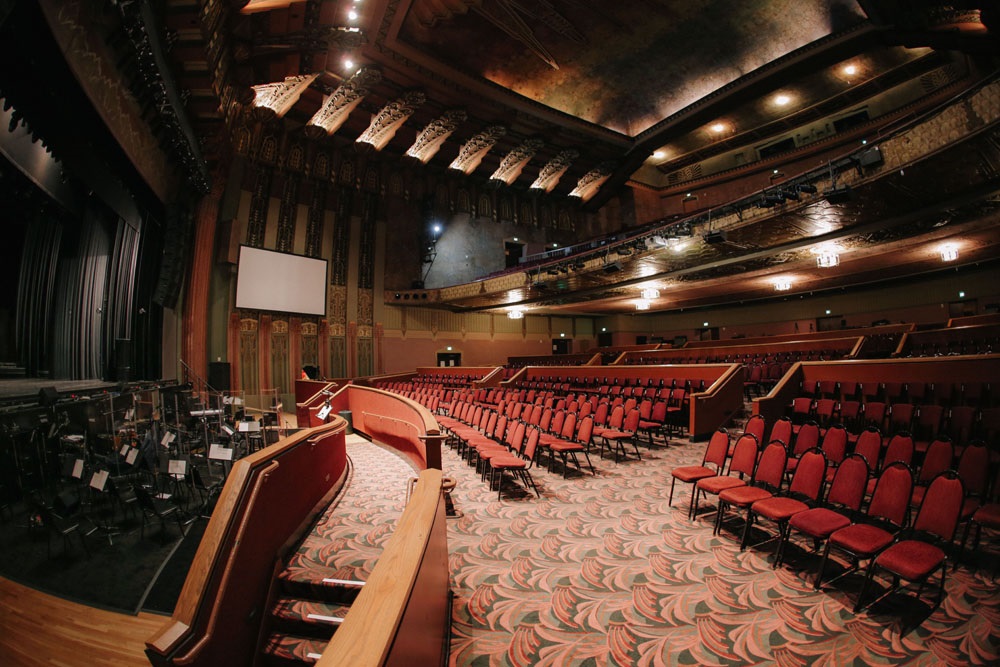
Auditorium (Auditorium)
Backstage Area (Stairwell) (Basement Dressing Room Stairwell)
 >
>
 >
>
 >
>
Basement (Basement Dressing Room Hallway)
Basement (Unknown Basement Dressing Room Hallway Room)
3790 Wilshire Blvd.
Los Angeles, CA 90010
http://www.wiltern.com
https://en.wikipedia.org/wiki/Pellissier Building and Wiltern Theatre
Photo Credit: Bill Counter (3-4)
 >
>
 >
>
 >
>
 >
>
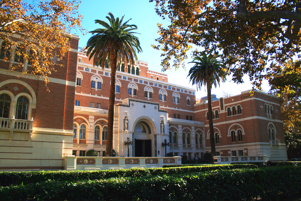
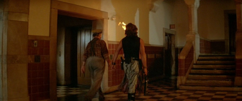
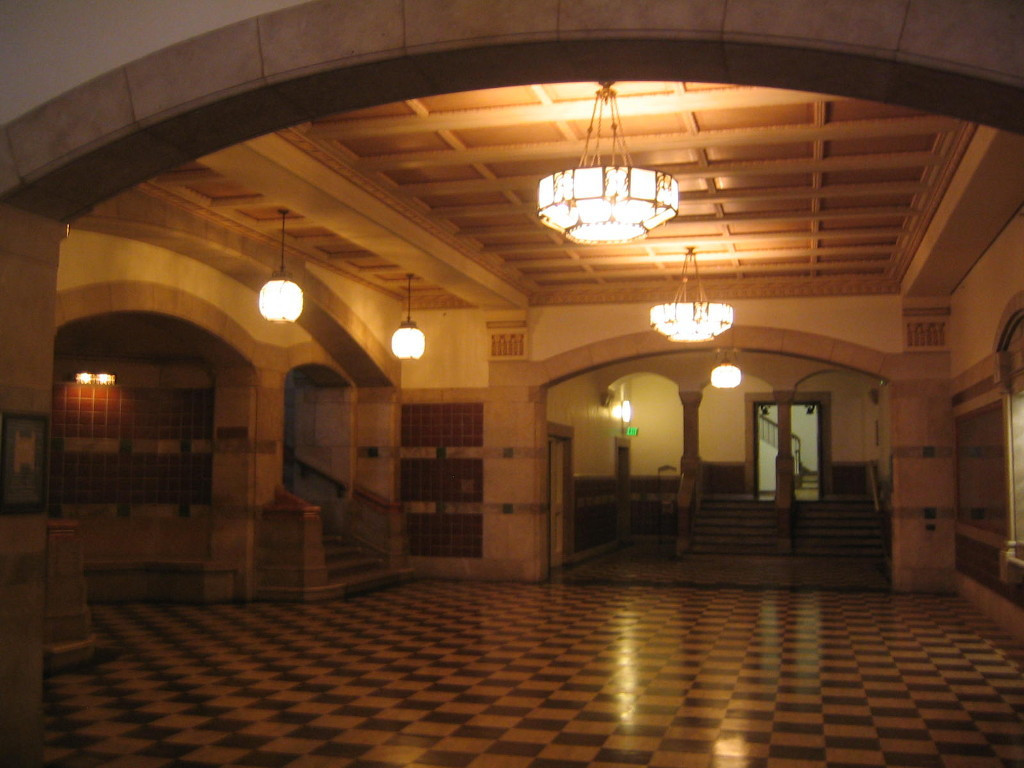
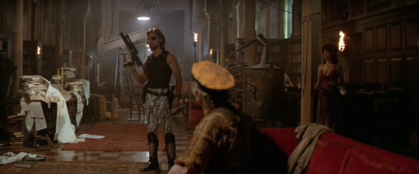
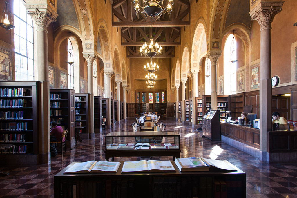
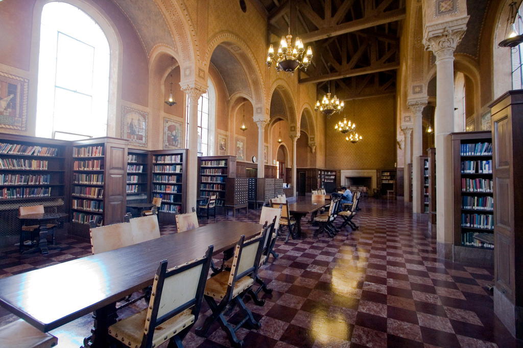
New York Public Library (Hall) (University of Southern California (USC), Doheny Memorial Library, Ground Level Central Hall, Los Angeles, CA) (Satellite View)
Description: The historic Edward L. Doheny Jr. Memorial Library has served as an intellectual center and cultural treasure for generations of students, faculty and staff since it opened in 1932. Created as a memorial to Edward L. Doheny Jr., a USC trustee and alumnus, this landmark building was USC's first freestanding library. 75 years since its doors first opened, it remains one of the university's most important and popular academic facilities.
3550 Trousdale Parkway
University Park Campus
Los Angeles, CA 90089-0185
http://www.usc.edu/libraries/locations/doheny/
Photo Credit: Ashley Naiyu Chen (1)
 >
>
 >
>
 >
>
 >
>
New York Public Library (University of Southern California (USC), Hoose Library of Philosophy, USC College School of Philosophy, Los Angeles, CA) (Street View)
Description: The Hoose Library of Philosophy was established in 1929. The collection has more than 50,000 volumes in all branches of academic philosophy. It is particularly rich in materials dealing with the history of modern philosophy, analytical philosophy and metaphysics. The library collects all major English language publications pertaining to academic philosophy. Most of the library's older circulating volumes are stored in the Grand Depository. If you are interested in one of these volumes, click on the highlighted call number on the bibliographic record in HOMER and follow the instructions. Within 24 hours, the desired volume will be available at the circulation desk at the Doheny Library.
The Hoose Library of Philosophy has two collections of rare books that are housed in Special Collections on the second floor of the Doheny Library. The first collection, called the Flewelling Collection, consists of medieval manuscripts, renaissance incunabula and early editions of seminal works in philosophy of the 16th and 17th centuries. The second collection, called the Gomperz Collection, consists of first editions of seminal philosophical works from the 18th and 19th centuries. The Gomperz Collection is particularly rich in German philosophy from the Enlightenment through the epochs of romanticism and idealism. The journal collection of the Hoose Library is extensive. Many of these journals are also available in electronic format.
3709 Trousdale Parkway
Los Angeles, CA 90089-0182
http://dornsife.usc.edu/phil/home/index.cfm
69th Street Bridge (Maggie's Corpse) (Studio City, Garage, Los Angeles, CA)
New York
 >
>
 >
>
 >
>
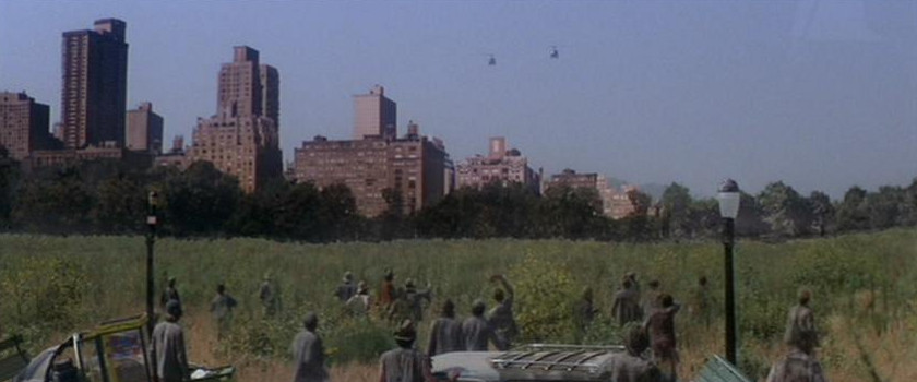
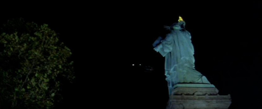
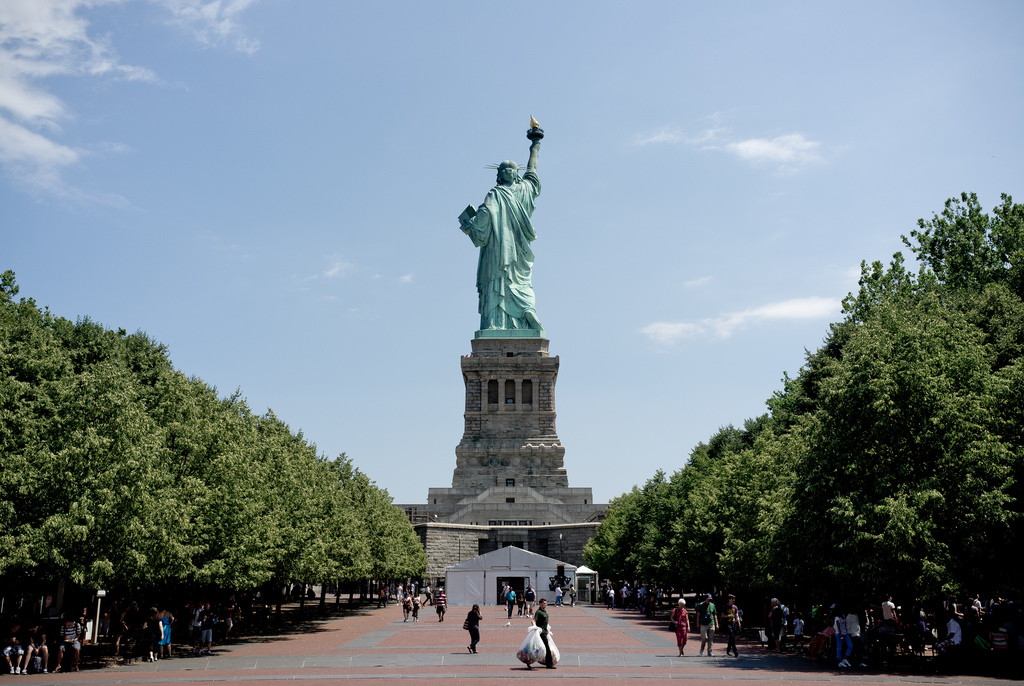
Liberty Island Security Control (Statue Of Liberty)/Manhattan (Liberty Island, NY) (Street View)
Description: Liberty Island, formerly called Bedloe's Island, is a small uninhabited island in New York Harbor in the United States, best known as the location of the Statue of Liberty. The name Liberty Island has been in use since the early 20th century, although the name was not officially changed until 1956. Before the Statue of Liberty, Bedloe's Island was the home to Fort Wood, an eleven pointed star-shaped fortification made of granite. Because of this, its nickname was "Star Fort".
Mouth of the Hudson River, NY
http://www.nps.gov/stli/index.htm
http://www.libertyellisfoundation.org/
https://en.wikipedia.org/wiki/Liberty Island
Escape From L.A.
Studios/Facilities:
Pacific Tube Stage (Firebase 7/Air Force 3/Submarine Interiors/Los Angeles Memorial Coliseum Sewer/Green-Screen Scenes)
Buena Vista Visual Effects Studio (Helicopter Miniature/Puppet Hang Gliders)
500 S. Buena Vista St., Burbank, CA 91521
California

Street (Los Angeles) (Deleted Scenes) (Mignonette & Boylston St., Los Angeles, CA) (Satellite View)
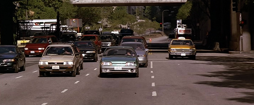
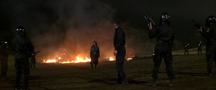
Comment (Gregory Alpert/Location Manager): "Boy that was a busy day, I remember it very clearly. We shot that scene the night we shot our only day work (daytime filming) on the show. We shot 69 nights and only 1 day on the film. That day we shot the car crash sequence on Flower Street in front of the Bonaventure Hotel, and the shots outside Union Station. We shot the scene at what was at the time, an empty plot of land, littered with junk, and shanty towns where homeless folks used to live. It was a swath of land West of the 110 Fwy. & South of the 101 Fwy. Roughly between Beaudry Ave. & Boylston St. There is now a school there. I remember being told that John had shot a scene from another one of his films (They Live) in this exact area."
Street (United States Police Force) (524 N. Spring St., Los Angeles, CA) (Street View)
 (Street
View) >
(Street
View) >
 (Street
View)
(Street
View)4th S. Flower St. (4th S. Flower St., Los Angeles, CA)
 >
>
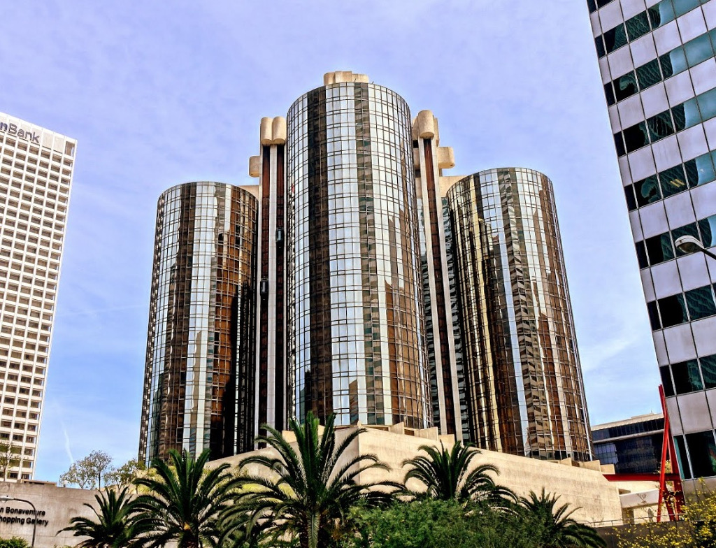
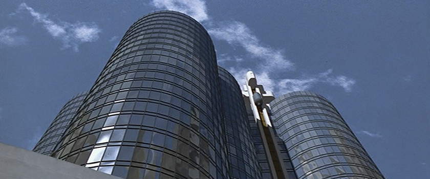
Westin Bonaventure Hotel & Suits (Westin Bonaventure Hotel & Suits, Los Angeles, CA) (Street View)
Description: The Westin Bonaventure Hotel and Suites is a 367-foot (112 m), 35-story hotel in Los Angeles, California, constructed between 1974 and 1976. Designed by architect John C. Portman, Jr., it is the largest hotel in the city. The top floor has a revolving restaurant and bar. It was originally owned by investors that included a subsidiary of Japanese conglomerate Mitsubishi Corporation and John Portman & Associates. The building is managed by Interstate Hotels & Resorts (IHR), and is valued at US$200 million.
404 South Figueroa Street
Los Angeles, CA 90071
https://www.marriott.com/hotels/travel/laxbw-the-westin-bonaventure-hotel-and-suites-los-angeles/
https://en.wikipedia.org/wiki/Westin Bonaventure Hotel
 >
>
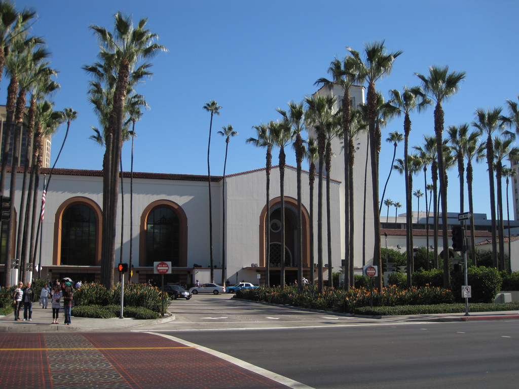
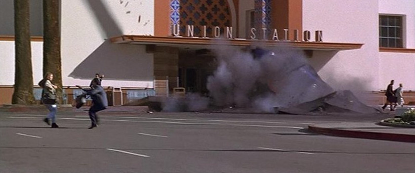
Los Angeles Union Station (Los Angeles Union Station, Los Angeles, CA) (Street View)
Description: Los Angeles Union Station (or LAUS, formerly the Los Angeles Union Passenger Terminal or LAUPT) is the main railway station in Los Angeles, The station has rail services by Amtrak and Amtrak California and Metrolink; light rail/subways are the Metro Rail Red Line, Purple Line, Gold Line. California. Bus rapid transport runs on the Silver Line. Bus services operate from the Patsaouras Transit Plaza on the east side of the station and others on the north side of the station. The station opened in May 1939, one of a number of union stations in the United States. It was built on a grand scale and became known as "Last of the Great Railway Stations" built in the USA. It was placed on the National Register of Historic Places in 1980. Since February 2011 it is in the ownership of the Los Angeles County Metropolitan Transportation Authority.
800 N. Alameda Street
Los Angeles, CA 90012
http://www.amtrak.com/servlet/ContentServer?pagename=am/am2Station/Station Page&code=LAX
https://en.wikipedia.org/wiki/Union Station (Los Angeles)
 >
>

Los Angeles Union Station/The Four Level Interchange (Miniatures) (The Acton Movie Ranch, Acton, CA) (Satellite View)
Description: Established in 2005, Acton Movie Ranch was built on a dream of providing exceptional, scenic outdoor backdrop for movie shoots. We have an active and robust Acton Movie Ranch filming location.
3840 Crown Valley Road
Acton, CA
http://www.actonmovieranch.com/
 >
>
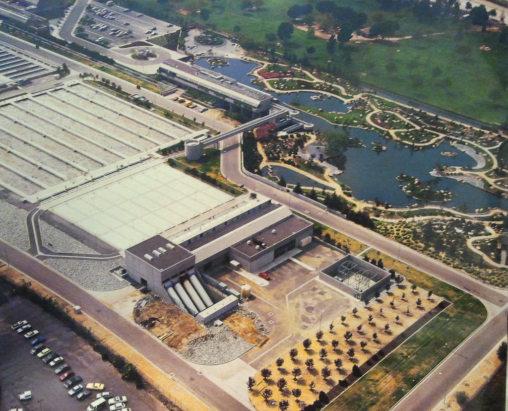
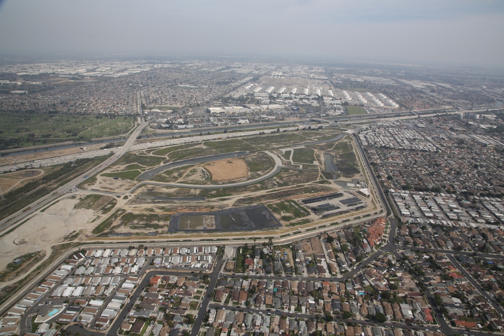
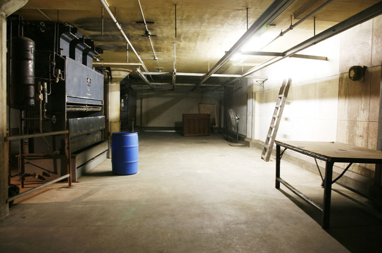
Firebase 7 (Entrance)/Prototype Defense Lab/Access Tunnel (Donald C. Tillman Water Reclamation Plant, Van Nuys, Los Angeles, CA) (Satellite View)
Description: The Donald C. Tillman Water Reclamation Plant began continuous operation in 1985. Its facilities were designed to treat 40 million gallons of wastewater per day and serve the area between Chatsworth and Van Nuys in western portion of the San Fernando Valley. The plant was named after Mr. Tillman, who was the City Engineer from 1972 to 1980.
A major construction project that doubled the capacity of DCT was completed in 1991 – expanding the plant from 40 MGD to 80 MGD.
The Tillman Plant, together with the Los Angeles-Glendale Water Reclamation Plant are the leading producers of reclaimed water in the San Fernando Valley. The plant is able to provide critical hydraulic relief to the City's major sewers downstream, which badly need the additional capacity to serve other portions of the city south of the Valley.
6100 Woodley Ave
Van Nuys, Los Angeles, CA 91406
http://www.lasewers.org/treatment plants/tillman/index.htm
http://www.thejapanesegarden.com
https://en.wikipedia.org/wiki/Tillman Water Reclamation Plant
 >
>
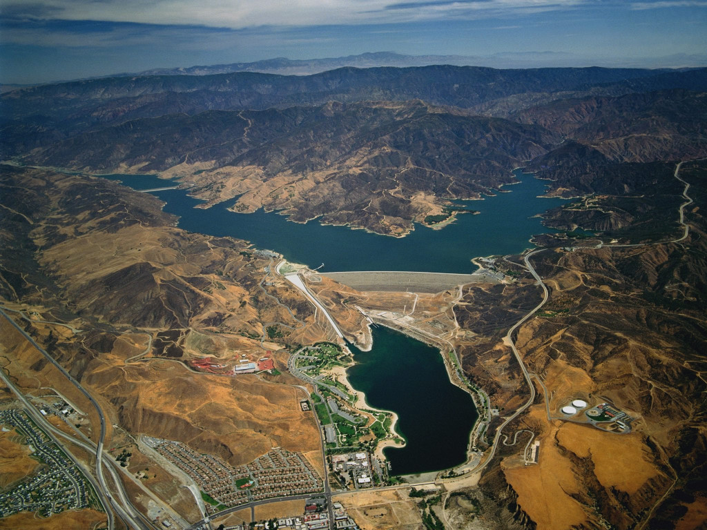
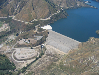
Cahuenga Pass (Shoreline) (Castaic Lake, Main Ramp Rd, Castaic, CA) (Satellite View)
Description: Run by the County of Los Angeles Department of Parks and Recreation, Castaic Lake is a beautiful state water reservoir located just north of Santa Clarita on the Interstate 5 Freeway.
Along with providing fresh water to local communities, Castaic Lake has also remained dedicated to providing the public with a wonderful place to have fun! Whether you come to admire, relax and reflect upon the beauty, or pack in an extreme day of fun and excitement, there is something here for everybody!
Comment (Gregory Alpert/Location Manager): "We filmed at Castaic Lake (north of LA) on the eastern shore, off Lake Hughes Road. We had a practical "prop" submarine, and it was built CG as well. The "cliff" element was CG."
Comment (Andreas/Webmaster): "This scene was originally going to be filmed at Lake Piru."
32132 Castaic Lake Drive
Castaic, CA 91384
http://www.castaiclake.com/
https://en.wikipedia.org/wiki/Castaic Lake
 >
>
Cahuenga Pass (Shoreline) (Lake Piru, Santa Felicia Dam, Piru, CA) (Satellite View)
Description: Lake Piru is an artificial lake located in Los Padres National Forest of Ventura County, California, created by the construction in 1955 of the Santa Felicia Dam on Piru Creek, which is a tributary of the Santa Clara River. The Lake Piru Recreation Area, along the western shore, has about 60 acres (24 ha) with various recreational facilities for camping, boating, fishing, swimming, and picnicking. The 238 campsites have water and electric hookup along with a snack bar. There are 66 boat slips with a full-service marina. The lake is situated downstream from Pyramid Lake and can be accessed from Piru Canyon Road near the town of Piru, California
The elevation of the lake is 1,043 ft (318 m), and the elevation of the dam spillway is 1,055 ft (322 m). The dam is owned and operated by the United Water Conservation District of Santa Paula, California. The district is a multi-service district providing flood control, recreation services, surface and groundwater conservation, groundwater replenishment, and wholesale water for agriculture and urban uses to the Santa Clara River Valley and Oxnard Plain. Formed on December 5, 1950, under the Water Conservation Act of 1931, it owns approximately 2,200-acre around and including the lake and dam (890 ha).
Quagga mussels became established in the Lake Piru and then downstream in the Lower Piru Creek in 2013. While this was the first discovery in Ventura County, they are an invasive species found in various rivers and lakes in the US. As of 2014, the district will be exploring options using a technical panel consisting of state Fish and Wildlife staff as well as representatives from the National Marine Fisheries Service and other federal, state, and local agencies. The district has to develop plans to deal with further colonization. The Casitas Municipal Water District that manages nearby Lake Casitas suggested that the reservoir be drained. Poisoning it with a potassium solution was also considered.
Comment (Andreas/Webmaster): "The submarine landing scene was filmed here as well but due to John Carpenter's disappointment with the look of the submarine they decided not to use the footage. The sub was originally going to land on a hillside and slide back towards the water with Snake in it. It wasn't suppose to land on a broken house foundation and then break it as seen in the final movie. Instead they filmed the sub sinking/surfers part at Castaic Lake and the Kurt Russell part in their studio in Commerce."
4780 Piru Canyon Rd
Piru, CA 93040
http://campone.com/campsites/lake-piru/
http://www.unitedwater.org/resource-conservation-3/santa-felicia-dam
https://en.wikipedia.org/wiki/Lake Piru
 (Satellite
View)
>
(Satellite
View)
>
 (Satellite
View)
>
(Satellite
View)
>
Mulholland Drive/Mountainside (Mt. Hollywood Drive, Griffith Park, Los Angeles, CA)
Description (Griffith Park): Griffith Park a large municipal park at the eastern end of the Santa Monica Mountains in the Los Feliz neighborhood of Los Angeles, California. The park covers 4,310 acres (1,740 ha) of land, making it one of the largest urban parks in North America. It is the second-largest city park in California, after Mission Trails Preserve in San Diego, and the tenth largest municipally owned park in the United States. It has also been referred to as the Central Park of Los Angeles, but it is much larger and with a much more untamed, rugged character than its New York City counterpart.
Description: (Mt. Hollywood Drive): For a number of years Mount Hollywood Drive, which runs from behind the Griffith Observatory (just north of the tunnel) over the top of Mount Hollywood and down into the San Fernando Valley, has been closed to cars. It is one of the few hill-routes bicyclists can ride without concern for cars. Recently, the condition of the roadbed has become a bigger concern than any auto traffic could pose. Present conditions are such that patching and other cosmetics now could extend the useful life of the surface, but if this roadway continues to be neglected, it will soon be impassible and expensive to restore.
Comment (Andreas/Webmaster): "These scenes were filmed at the top of Mt. Hollywood Drive and can be seen between 0:22-0:40 in this YouTube video."
4730 Crystal Springs Drive
Los Angeles, CA 90027
http://www.laparks.org/dos/parks/griffithPK/griffith.htm
https://en.wikipedia.org/wiki/Griffith Park
 >
>
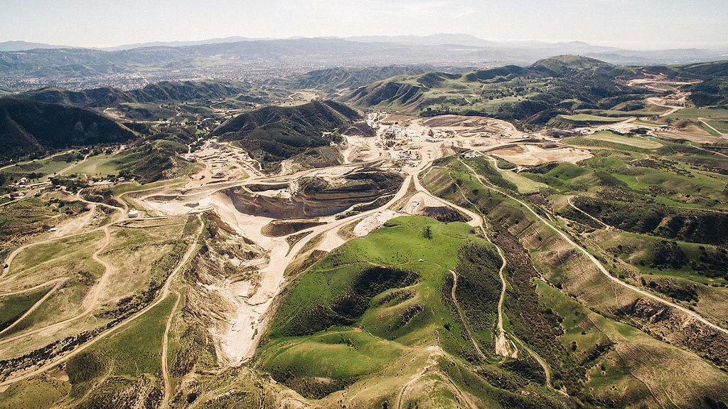
Hollywood Bowl (Hills) (Deleted Scenes) (P.W. Gillibrand Co. Inc., Simi Valley, CA) (Satellite View)
Description: P.W. Gillibrand Co., Inc. is committed to being the Specialty Aggregate Products "Supplier of Choice" in the Southwest. We will provide quality products, excellent service, leading technology and added value in meeting and exceeding customer expectations. We will provide a safe workplace, respect and protect the environment and act with integrity in dealing with our employees, customers and community.
5810 Bennet Rd.
Simi Valley, CA 93062
http://www.pwgillibrand.com/
 (Street
View) >
(Street
View) >
 >
>
 (Street
View)
(Street
View)Hollywood Boulevard/Alley (7th St. btw Broadway & Hill, Los Angeles, CA)
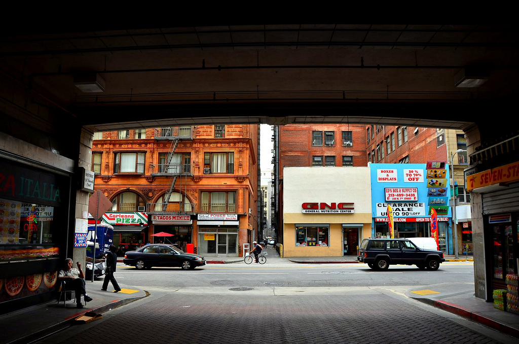
Theater (Los Angeles Theatre, Los Angeles, CA) (Broadway Theater District) (Street View)
Description: The Los Angeles Theatre, built in 1931, is a National Register landmark located in the heart of the Los Angeles Broadway Historic Theatre District. The Theatre was the last and most elaborate of the movie palaces built on Broadway between 1911 and 1931. When it opened in January of 1931 it was advertised as "The Theatre Unusual" because of its many unique features.
The Los Angeles Theatre was designed by architect S. Charles Lee in the Baroque style. Lee filled the theatre with glamour, glitz, technical innovations and sumptuous audience conveniences. With a construction cost of over $1.5 million, the Los Angeles was the most expensive theatre built up to that time on a per seat basis. On opening night the theatre hosted the premier gala screening of Charles Chaplin's City Lights. Among celebrities of the era in attendance that evening was Mr. Albert Einstein.
City Lights was only the first of many openings and first run screenings. The Los Angeles flourished as the heart of the Broadway Entertainment District into the 1960s. As the fortunes of Downtown declined, the interest and attendance of the Los Angeles Theatre waned until it closed its doors to regular screenings in the 1990s. Sustained as a film location and through special events, including the star studded opening of Chaplin, the Los Angeles has waited for a resurgence of Downtown. This new century will see the Los Angeles Theatre return to past glory and place as the heart of our city's entertainment district.
 >
>
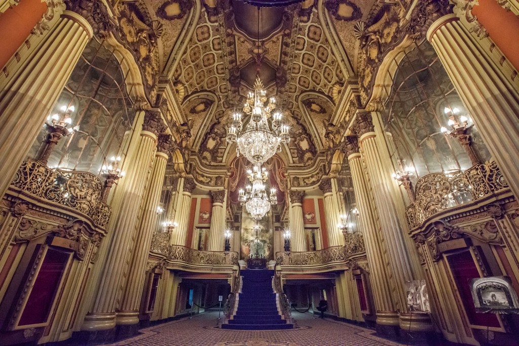
Lobby (Lobby)
 >
>
Upper Lobby (Upper Lobby)
615 S. Broadway
Los Angeles, CA
http://www.losangelestheatre.com/
https://en.wikipedia.org/wiki/Los Angeles Theatre
http://www.bringingbackbroadway.com/index.htm
Photo Credit: Mike Hume (2)
 >
>
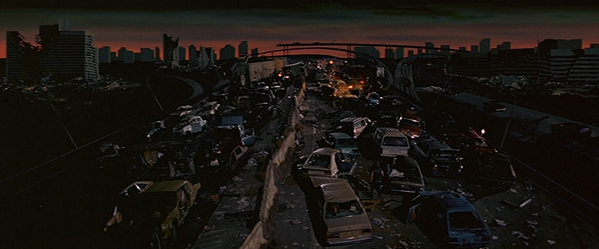
Sunset Boulevard/Beverly Hills Hotel (Entrance)/Santa Monica Freeway (Former Cal Compact Landfill, Carson, CA) (Satellite View)
Description: The Avalon of South Bay (ASB) site encompasses 168 acres on two parcels, the 157 acre former Cal Compact Landfill parcel and an adjacent 11-acre, non-landfill parcel. DTSC is the lead regulatory agency for the brownfield restoration project for the 157 acre former Cal Compact Landfill parcel. The former Cal Compact Landfill consists of five separate landfill cells numbered A1 through A5 separated by the site boundaries on the outer perimeter and on the interior by two roadways (Former Leonardo and Stamps Drives), a Los Angeles County flood control channel (Torrance Lateral) is located adjacent to the south and west sides of the project site and serves to separate the project site from the adjacent uses. Because the property was previously a landfill site, elevated levels of chemicals of concern were found in the landfill and groundwater. While there is no immediate health risk because the public is not exposed to the landfill waste or groundwater, a restoration plan will ensure that future site occupants and users are not exposed.
Since 1988, DTSC has conducted several investigations of the former Cal Compact Landfill property. Due to the size and complexity of the site, the property was divided into two "operable units" (OUs). In 1995, a Remediation Action Plan (RAP) was completed and approved by DTSC for the upper OU. In 2005, a RAP was completed and approved by DTSC for the lower OU. Investigations conducted in the Upper OU showed presence of landfill gasses such as methane, carbon dioxide and volatile organic compounds, as well as metals in the Upper OU. Investigations conducted in the Lower OU have not resulted in any active requirement for remediation besides monitoring. Each of the RAP's summarizes how their mitigation measures are being used to prevent future exposure to landfill waste.
Its story is a tangled, four-decade tale of polluted air and poisoned groundwater and failed plans for shopping malls, mobile home parks. And bankruptcies, lawsuits and criminal cases that include a fraud prosecution of a former labor union pension administrator. It is the largest undeveloped single piece of freeway-adjacent land in Los Angeles County. There has also been plans to build a Stadium at the former landfill for many years that would house both the San Diego Chargers and the Oakland Raider's NFL football teams.
20400 Main St.
Carson, CA
https://www.dtsc.ca.gov/SiteCleanup/Projects/upload/Cal Compact FS Site Restoration.pdf
 >
>
 >
>
Beverly Hills Hotel (Pacific Electric Building, Los Angeles, CA) (Street View)
Description: The historic Pacific Electric Building (also known as the Huntington Building, after the Pacific Electric founder and developer, Henry Huntington, or 6th & Main for its location) opened in 1905 as the terminal for the Pacific Electric Red Car Lines running east and south of downtown Los Angeles, as well as the company's main headquarters building. It was designed by architect Thornton Fitzhugh. Though not the first modern building in Los Angeles, nor the tallest, its large footprint and ten-floor height made it the largest building in floor area west of Chicago for several decades. Above the main floor terminal were five floors of offices and on the top three floors, the Jonathan Club, one of the city's leading businessmen's clubs. The club moved to its own building on Figueroa Street in 1925. After the absorption of the Pacific Electric into the Southern Pacific Railroad in 1911 (called "The Great Merger"), the PE Building became the primary Los Angeles offices for the Southern Pacific.
Comment (Gregory Alpert/Location Manager): "When we shot there it was an abandoned bldg. It has since been converted to lofts. The top two floors shared an atrium (stairs). We also used this on another John Carpenter project: Body Bags."
610 S. Main St.
Los Angeles, CA 90014
http://www.pelofts.com/
https://en.wikipedia.org/wiki/Pacific Electric Building
 >
>
 >
>
Beverly Hills Sewer Tunnel (The Belmont Tunnel (Hollywood Subway)/Toluca Substation and Yard, Subway Terminal Building (Metro 417), Los Angeles, CA) (Street View)
Description (Belmont Tunnel/Toluca): It's not commonly known, but LA's first subway system was a mile-long stretch of underground trackage for some of Pacific Electric's Hollywood line of Red Car. Opened in 1925, the subway ran from the Terminal Building at 417 South Hill Street in Downtown to Belmont Tunnel/Toluca Substation at 2nd Street and Glendale Boulevard. From there, trolley service continued at street level to Hollywood and beyond. After a 30-year run, the subway was shut down and Belmont Tunnel/Toluca Yard remained abandoned for many years, attracting graffiti artists and transients in later years. In 2004, a real estate company bought the land with plans to build an apartment complex. Belmont Station now stands directly in the old Red Car path, but the sealed-off tunnel and original station can still be seen behind the building, beautifully restored.
Description (Subway Terminal Building): The Subway Terminal Building, now Metro 417, is an Italian Renaissance Revival building in Downtown Los Angeles at 417 South Hill Street. It was designed by architects Schultze and Weaver and was built in 1925. It was the downtown terminus for the "Hollywood Subway" branch of the Pacific Electric Railway Interurban rail line. Currently it is a luxury apartment building. It is near Pershing Square. When the LACMTA Red Line, the replacement for the Hollywood Subway, was built, the Pershing Square station was located nearby.
417 S. Hill St.
Los Angeles, CA 90013
https://en.wikipedia.org/wiki/Belmont Tunnel/Toluca Substation and Yard
http://laist.com/2008/07/12/laistory the 19.php
http://www.awalkerinla.com/2012/05/11/las-original-subway/
https://en.wikipedia.org/wiki/Subway Terminal Building
http://www.metro417.com/
 (Street
View)
>
(Street
View)
>
 (Street
View) >
(Street
View) >
 >
>
 (Street
View)
(Street
View) 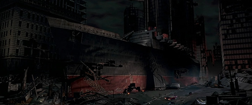 (Street
View)
(Street
View)Street Under Santa Monica Freeway Overpass/Santa Monica Freeway (Parallel Street)/Queen Mary (Entrance) (7th St. & Long Beach Fwy, Long Beach, CA)
Comment (Andreas/Webmaster): "This tunnel is open to bikes and pedestrians only and leads to the Los Angeles River bicycle path. The first part of the tunnel seen in scene three is located beneath a small unused section of freeway."
Devastated Streets (Victory Blvd at Vanalden, Reseda, CA) (Street View)
Description: The 1994 Northridge earthquake occurred on January 17, at 4:30:55 a.m. PST and had its epicenter in Reseda, a neighborhood in the north-central San Fernando Valley region of Los Angeles, California. It had a duration of approximately 10–20 seconds. The blind thrust earthquake had a moment magnitude (MMS) of 6.7, which produced ground acceleration that was the highest ever instrumentally recorded in an urban area in North America, measuring 1.8g (16.7 m/s2) with strong ground motion felt as far away as Las Vegas, Nevada, about 220 miles (360 km) from the epicenter. The peak ground velocity in this earthquake at the Rinaldi Receiving Station was 183 cm/s (4.09 mph or 6.59 km/h), the fastest peak ground velocity ever recorded. In addition, two 6.0 MMS aftershocks occurred, the first about one minute after the initial event and the second approximately 11 hours later, the strongest of several thousand aftershocks in all. The death toll was 57, with more than 5,000 injured. In addition, earthquake-caused property damage was estimated to be between $13 and $40 billion, making it one of the costliest natural disasters in U.S. history.
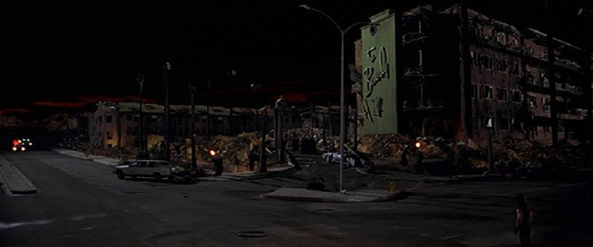
Comment (Gregory Alpert/Location Manager): "We shot it in Northridge, CA. The big quake in LA on Jan. 17, 1994 was centered in Northridge. We found a long block of houses that had their backsides completely sliced away. It took a lot of work to be able to shoot it (because of safety concerns) but we did. We shot in both directions, so that when we looked towards Snake from the drivers side, or at Map to the Stars Eddie from the passenger side, it would look like there were dilapidated buildings on both sides. It looked really good!"
https://en.wikipedia.org/wiki/1994 Northridge earthquake
 >
>
 >
>
 >
>
 >
>
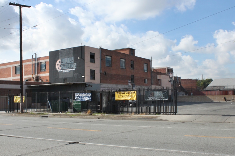
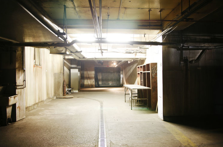
Los Angeles Memorial Coliseum (Locker Room) (Morell Meats Building, Willow Studios, Basement, Los Angeles, CA) (Street View)
Comment (Gregory Alpert/Location Manager): "It was an empty building when we shot, way past it's prime, and a popular filming location back in the early 90's."
Comment (Andreas/Webmaster): "These scenes were originally going to be filmed at El Camino College."
1335 Willow St.
Los Angeles, CA 90013
http://willowstudios.net/
 (Satellite
View)
>
(Satellite
View)
>
 (Satellite
View) >
(Satellite
View) >
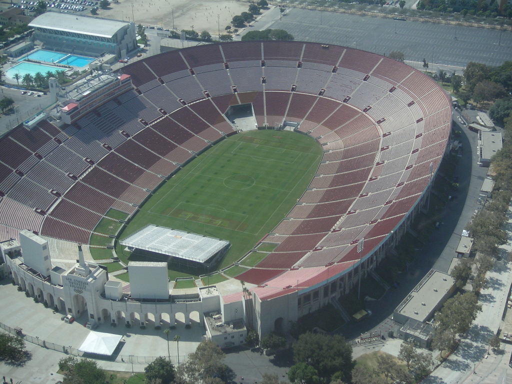
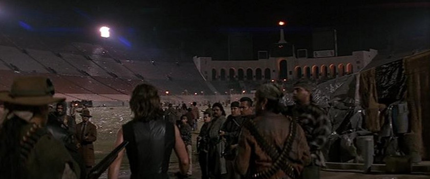
Los Angeles Memorial Coliseum (Los Angeles Memorial Coliseum, Los Angeles, CA)
Description: The Los Angeles Memorial Coliseum opened June of 1923; some 5 months later, on October 6th, the first football game was played in the stadium, with the University of Southern California defeating Pomona College 23-7 before a crowd of 12,836. It was a modest beginning for a venue that would later play a very prominent role in college and professional football, and become the greatest stadium in the history of America.
In addition to serving as the home field for the USC Trojans since 1923, countless historic events have taken place inside these venerable walls during nine decades of celebrated history. It is the only facility in the world to play host to two Olympiads (X and XXIII), two Super Bowls (I and VII), one World Series (1959), a Papal Mass and visits by three U.S. Presidents: John F. Kennedy, Richard M. Nixon and Ronald Reagan.
Along with the adjacent Sports Arena, the Coliseum is credited with helping to start the migration of professional sports teams to the West Coast. The complex provided a home for the Rams (from Cleveland, 1946-79 NFL), the Dodgers (from Brooklyn, 1958-61, MLB), and the Lakers (from Minneapolis, 1960-67, NBA), and has also been home to a variety of Southern California teams as well the Raiders (from Oakland, 1982-94, NFL), UCLA Football (1933-81) and was the expansion home of the Chargers (1960, NFL) the Clippers (from San Diego, 1984-99, NBA), USC Basketball (1959-2006, NCAA), UCLA Basketball (1959-65, NCAA), the Cobras (1988, Arena Football), the Ice Dogs (1995-96, IHL), the Sharks (1972-74, WHA), the Stars (1968-70, ABA) and Kings (1967, NHL).
In 1984, the State of California and the United States Government declared the Coliseum a State and Federal Historical Landmark for its contribution to the history of California, as well as to that of the United States as a whole.
On March 29, 2008, the Los Angeles Dodgers and the Boston Red Sox set a Guinness World Record for the largest attendance ever at a baseball game with a crowd of 115,300. Other historic events include Billy Graham's appearance in 1963 in front of 134,254 (still an all-time Coliseum record), Nelson Mandela’s 1990 triumphant return to the United States, the first ever Papal Mass by Pope John Paul II in 1987, and the 1976 Bicentennial Spectacular.
The Coliseum has hosted decades of memorable concerts including a who’s-who listing of some of rock-n-roll’s greatest artists: Roger Waters performing The Wall in its entirety (May 19, 2012), LA Rising (June of 2011), the Summer Sanitarium Tour (headlined by Metallica – August 2003), Bruce Springsteen in 1985, four sold-out Rolling Stones, U2, Metallica, The Who, Pink Floyd, Kid Rock, the Grateful Dead, Van Halen and More!
A new mark for the highest paid attendance (63,101) for a Latin music concert in the United States was set on March 18, 2006, as RBD took the Coliseum stage.
Known also for hosting soccer competitions, the Coliseum has been the site of many memorable international matches. The all-time Coliseum attendance record for a soccer match was set on August 6, 2006, as 92,650 fans turned out to see a double-header featuring Chivas vs. Barcelona and Chivas USA vs. the New England Revolution. The crowd eclipsed the previous mark of 91,585, set in 1999 as Mexico took on Argentina. The 2014 Centroamericana Cup Championships and five CONCACAF Gold Cups.
Comment (Andreas/Webmaster): "These scenes were originally going to be filmed at El Camino College."
3911 S Figueroa St.
Los Angeles, CA 90037
http://www.lacoliseum.com
https://en.wikipedia.org/wiki/Los Angeles Memorial Coliseum
 >
>
Wilshire Canyon (Tapo Rock & Sand, Inc., Quarry, Simi Valley, CA) (Satellite View)
Description: Tapo Rock and Sand has been in the rock and sand, building aggregate, and recycling business for over 43 years. Family owned and operated, Tapo Rock and Sand was founded in 1972 by owner and operator Charlie Brooks, and continues under his leadership today. We have always strived to provide our customers with excellent and friendly service, and the best quality products in the industry. We carry a wide array of materials, and also offer recycling sights for dirt, sod, and concrete.
Comment (Gregory Alpert/Location Manager): "It was our first night of filming. WE shot 69 nights, and just one day on the film. The quarry is located near Big Sky Ranch in Simi Valley, CA."
Comment (Clayton Sandland): "I remember when they filmed it. I was actually just a kid at the time, and wanted badly to go up to see the filming, but wasn't able to because they filmed it in the middle of the night. It was filmed on the third level of our pit. To the right is a bluff that is an adjoining property, and that sluff to the left was actually the road leading down to it. They are not there anymore. That road has been taken out, and that bluff has been backfilled and reclaimed. Our whole top level is now about the same as where Kurt Russell and Peter Fonda are standing."
5141 Tapo Canyon Road
Simi Valley, CA 93063
http://www.taporockandsand.com/
Wilshire Canyon (Street) (4th St. from Spring to Main St., Los Angeles, CA) (Street View)
Comment (Gregory Alpert/Location Manager): "If you look closely at the end of the block, you will see a bldg. on the right side that has a triangle feature located above a window on it. This is the old Farmer's & Merchants Bank."
 >
>
 >
>
 >
>
Wilshire Canyon (Alley) (Harlem Place Alley btw 4th and 5th St., Los Angeles, CA) (Street View)
Comment (Gregory Alpert/Location Manager): "In the 80 & 90's this alley was filmed ALL the time, and I mean ALL the time for films and TV shows. Starting in the early to mid 2000's filming in the alley slowed way down as the once empty commercial part of town started having the buildings turn to condos. What was once a ghost town at night, where you could do anything, explosions, full load gun fire and the like started having restrictions put in place, due to the fact residents were now occupying adjacent buildings. I have mixed feelings about this, as it took away a great place to film at night, but on the other hand, a once dead downtown is being revitalized with people moving downtown. Nothing ever stays the same!"
 >
>
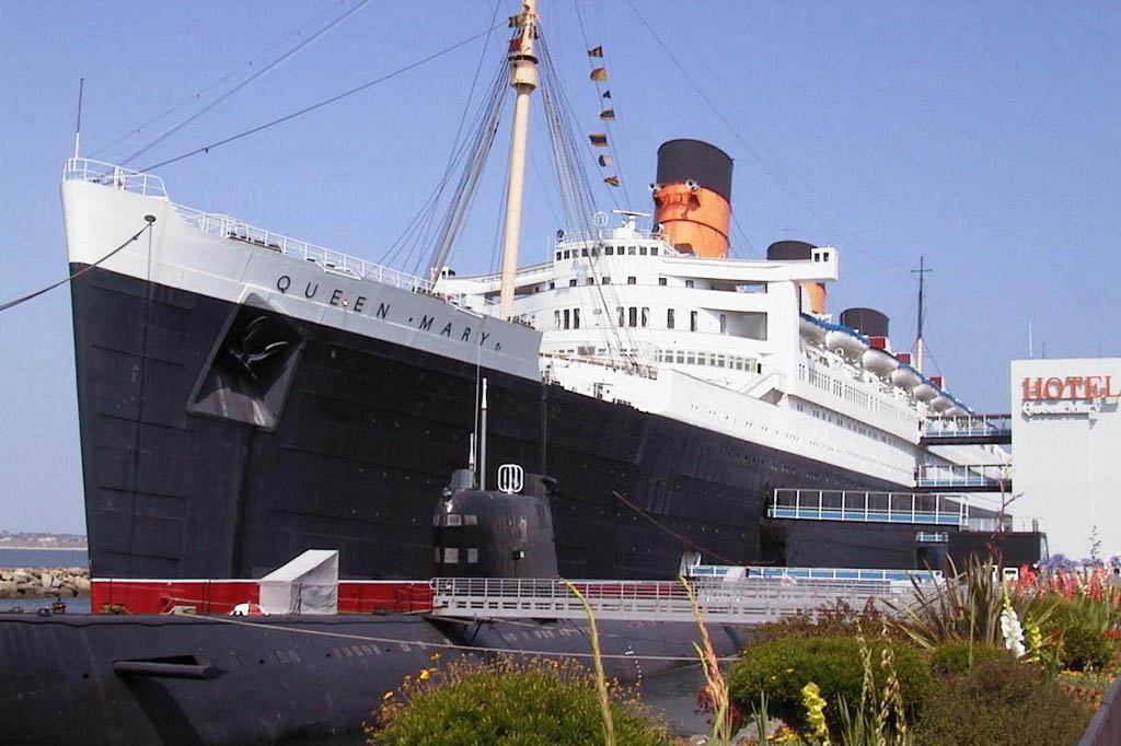
Queen Mary (Bowel) (Queen Mary, Bowel, Long Beach, CA) (Street View)
Description: RMS Queen Mary is a retired ocean liner that sailed primarily on the North Atlantic Ocean from 1936 to 1967 for the Cunard Line (known as Cunard-White Star Line when the vessel entered service). Built by John Brown & Company in Clydebank, Scotland, Queen Mary along with her running mate, the RMS Queen Elizabeth, were built as part of Cunard's planned two-ship weekly express service between Southampton, Cherbourg, and New York City. The two ships were a British response to the superliners built by German and French companies in the late 1920s and early 1930s. Queen Mary was the flagship of the Cunard Line from May 1936 until October 1946 when she was replaced in that role by Queen Elizabeth.
Queen Mary sailed on her maiden voyage on 27 May 1936 and captured the Blue Riband in August of that year; she lost the title to SS Normandie in 1937 and recaptured it in 1938, holding it until 1952 when she was beaten by the new SS United States. With the outbreak of World War II, she was converted into a troopship and ferried Allied soldiers for the duration of the war. Following the war, Queen Mary was refitted for passenger service and along with Queen Elizabeth, commenced the two-ship transatlantic passenger service for which the two ships were initially built. The two ships dominated the transatlantic passenger transportation market until the dawn of the jet age in the late 1950s. By the mid-1960s, Queen Mary was ageing and, though still among the most popular transatlantic liners, was operating at a loss.
After several years of decreased profits for Cunard Line, Queen Mary was officially retired from service in 1967. She left Southampton for the last time on 31 October 1967 and sailed to the port of Long Beach, California, United States, where she remains permanently moored. Much of the machinery, including one of the two engine rooms, three of the four propellers, and all of the boilers, were removed, and the ship now serves as a tourist attraction featuring restaurants, a museum, and hotel. The ship is listed on the National Register of Historic Places. The National Trust for Historic Preservation has accepted the Queen Mary to be part of the Historic Hotels of America.
1126 Queens Highway
Long Beach, CA 90802
http://www.queenmary.com/
https://en.wikipedia.org/wiki/RMS Queen Mary
 >
>
 >
>
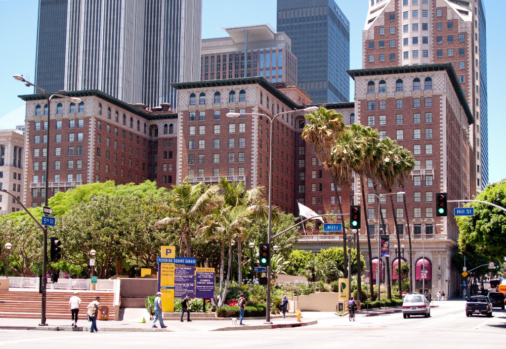
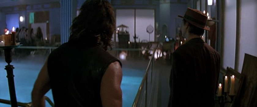
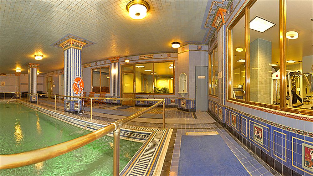
Queen Mary (Pool) (Millennium Biltmore Hotel, Pool, Los Angeles, CA) (Street View)
Description: The Millennium Biltmore Hotel, originally named the Los Angeles Biltmore Hotel of the Biltmore Hotels group, is a luxury hotel located on Pershing Square in Downtown Los Angeles, California, US. Upon its grand opening in 1923, the Los Angeles Biltmore was the largest hotel west of Chicago, Illinois in the United States. In 1969 the Biltmore Hotel was designated a Los Angeles Historic-Cultural Monument by the City of Los Angeles. As of 2009, the Los Angeles Biltmore is operated as part of the Millennium & Copthorne Hotels as the Millennium Biltmore Hotel. The hotel has 70,000 square feet (6,500 square meter) of meeting and banquet space. From its original 1500 guestrooms it now has 683, due to room reorganization.
Comment (Gregory Alpert/Location Manager): "The Pool. This was NOT shot at the ship, but rather inside the Biltmore Hotel, located in downtown LA. It has an underground art deco pool."
506 South Grand Avenue
Los Angeles, CA 90071
http://www.millenniumhotels.com/usa/millenniumbiltmorelosangeles/
https://en.wikipedia.org/wiki/Millennium Biltmore Hotel
 >
>
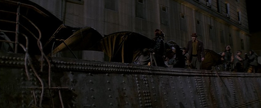
Queen Mary (Deck) (Hall of Justice, Parking Lot, Los Angeles, CA) (Street View)
Description: In Los Angeles the Hall of Justice was the centerpiece of the Los Angeles County justice system until it was damaged in the Northridge earthquake. The historic 1925 building was featured on television shows including Dragnet, Perry Mason and Get Smart. More significantly, it was the home of Los Angeles County courts, the Los Angeles County Coroner, the Los Angeles County Sheriff's Office, and the Los Angeles County District Attorney, and was for many years the primary Los Angeles County jail.
Notable residents of the Hall of Justice included Charles Manson, Sirhan Sirhan and Shorty Rossi, star of the Animal Planet show Pit Boss. Autopsies performed at the Hall of Justice include those of actress Marilyn Monroe and the assassinated presidential candidate and former United States Attorney General Robert Kennedy. It was used as a filming location for the 1997 Clint Eastwood movie Absolute Power, as the Washington DC police headquarters.
The Hall of Justice was closed shortly after sustaining damage as a result of the 1994 Northridge earthquake. Recently, the building underwent a complete restoration and is scheduled to re-open as the Sheriff's and District Attorney's Headquarters in early 2015.
Comment (Gregory Alpert/Location Manager): "The shot where they are standing on the deck of the ship before they fly off. This was a huge set piece set in a parking lot in downtown LA in front of an old government building (The Hall of Justice). Located between N. Broadway & N. Spring Street & E. Temple Street & the 101 Fwy. The building was red tagged because of the 1994 Northridge earthquake, and is just now, 20 years later being rehabbed. The building in the foreground was not there at the time. That was the parking lot where the huge set piece was placed."
Comment (Andreas/Webmaster): "This scene was originally going to be filmed at Universal Studios Courthouse Square."
211 W Temple St
Los Angeles, CA 90012
https://en.wikipedia.org/wiki/Hall of Justice
Photo Credit: Hunter Kerhart
 >
>
Happy Kingdom In Anaheim (Universal Studios Courthouse Square, Los Angeles, CA) (Satellite View)
Description: A large town square named after the imposing Courthouse building most famously seen in Back to the Future (1985-1990). The square has been seen in hundreds of Universal films (and those of other studios). In common with many other standing sets, simple changes like the arrangement of street furniture and signage can make the set appear to be a completely different location. Prior to Back to the Future, the area was known as Mockingbird Square, after it's appearance in To Kill a Mockingbird.
Although the devastating fires in 1990 and 2008 destroyed the New York Street area, the Courthouse itself was spared.
100 Universal City Plaza
Universal City, Los Angeles, CA
http://www.thestudiotour.com/ush/backlot/courthousesquare.shtml
https://en.wikipedia.org/wiki/Courthouse Square
 (Satellite
View)
>
(Satellite
View)
>
 (Satellite
View)
>
(Satellite
View)
>
Small Clearing (Ventura Farms, Hidden Valley, Thousand Oaks, CA)
Description: With the Santa Monica Mountains as a backdrop, the 2000 acres known as Ventura Farms caught the eye of David Murdock in 1978. Located just twenty-five minutes from the Pacific Ocean and nestled into one of Southern California's loveliest valleys, Mr. Murdock found a place of serenity for relaxation after days in his Los Angeles office. David Murdock, CEO of major companies on an international scale, remembers, "Most of all, the beauty of the place won me over. The farm is one of a kind."
Ventura Farms is a state of the art training facility with everything available for training and conditioning our Arabian horses. Located on the facility are a 1/8th mile track, equine swimming pool, treadmill, and horse Eurociser. We also enjoy the benefits of all weather training with a state-of-the-art covered arena and covered round pen.
Ventura Farms is primarily a private facility. Our focus is on training and conditioning the Ventura Farms horses to prepare them to be great horses for new owners.
235 W Potrero Rd
Thousand Oaks, CA 91361
http://www.venturafarms.com/
Texas
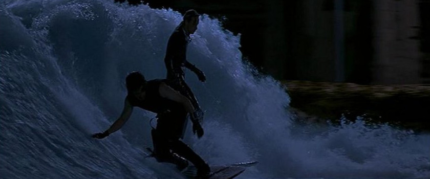 >
>
Wilshire Canyon (Canyon) (Schlitterbahn East, Boogie Bahn (FlowRider), New Braunfels, TX) (Satellite View)
Description (Schlitterbahn Waterpark Resort): Schlitterbahn Waterpark Resort in New Braunfels has over 3 miles of tubing adventures, 7 children’s water playgrounds, 17 water slides, the world’s first surfing machine, and 3 uphill water coasters spread over 65 acres of fun!
Description (FlowRider): A FlowRider (or Flow Rider) is an artificial sheet wave surfing environment incorporated in many waterparks and hotels. It was originally invented by Tom Lochtefeld, a surfer, for the Schlitterbahn Waterpark Resort in New Braunfels, Texas.
The Flow Rider is manufactured by Wave Loch, Inc. of La Jolla, California and range in cost anywhere from 1 million us dollars and onwards. There are currently more than 100 FlowRider installations around the globe, including five units on cruise ships. Wave Loch also has a mobile unit that can be moved by truck.
Comment (Tony Hawk/Uncredited Stunts/Instagram): "Doing "stunts" for Escape From L.A. in 1996 w/Chris Miller. I was Peter Fonda, he was Kurt Russell. We were riding real surfboards on the Flowrider in freezing conditions, and both ended up with the flu... but it was worth the pain to be part of this cinematic genius."
400 N Liberty Ave,
New Braunfels, TX 78130
http://www.schlitterbahn.com/nb/
http://www.waveloch.com/
https://en.wikipedia.org/wiki/Schlitterbahn